Kathleen Schiro (@kathleenschiro) 's Twitter Profile
Kathleen Schiro

@kathleenschiro

Assistant Professor @uvaevsc studying deep convection, cloud feedbacks, and regional hydroclimatology

ID: 125426373

linkhttp://schiro.evsc.virginia.edu calendar_today22-03-2010 19:37:27

344 Tweet

504 Followers

471 Following

Dylan B. Raines (@dylanbraines) 's Twitter Profile Photo

Mind blowing to see two hurricanes, #HurricaneJohn on the left (west coast of Mexico), and #HurricaneHelene (Big Bend region of Florida) on the right, both making landfall at nearly the same time. #Helene #John

Jeff Masters (@drjeffmasters) 's Twitter Profile Photo

Climate change makes the strongest hurricanes stronger, increases rainfall, increases storm surge damage through sea level rise, and increases the probability of rapid intensification events. I detail how for Hurricane Helene: yaleclimateconnections.org/2024/09/four-w…

CIRA (@cira_csu) 's Twitter Profile Photo

From tropical disturbance to a devastating Category 4 hurricane in two and a half days. Hurricane Helene's incredible evolution from the Caribbean Sea to Florida coastline.

Minghao Zhou (@minghao_zhou) 's Twitter Profile Photo

Progression of messaging from local forecast office, NWS GSP: 1/n "several inches of rain not out of the question" - 8 hours after the pre-#Helene disturbance designated a Potential Tropical Cyclone; 76 hours before landfall

NOAA Satellites (@noaasatellites) 's Twitter Profile Photo

.NOAA's Joint Polar Satellite System (JPSS) satellites captured the upwelling of water and sediment in the eastern Gulf of Mexico after Hurricane #Helene. The first image is from Sept. 24, and the second from Sept. 27, 2024.

CIRA (@cira_csu) 's Twitter Profile Photo

Rainfall ahead of Hurricane Helene primed the stage for devastating flooding across North Carolina. This view shows the evolution of both systems that ushered in tremendous amounts of rain.

Tomer Burg (@burgwx) 's Twitter Profile Photo

The Predecessor Rain Event (PRE) associated with Hurricane Helene can be visualized with radar & mid-troposphere heights (blue lines). Helene's interaction with a cutoff low brought a frontal boundary to a stall over western NC with a deep moisture plume well ahead of Helene:

Ella Dorsey (@ella__dorsey) 's Twitter Profile Photo

This is Anna Maria Island, near Tampa, after Helene. A complete loss- looks like a bomb went off. The residents didn’t have time to clear this debris before having to evacuate again for Hurricane Milton, which will be a major hurricane when it hits on Wednesday. Heart breaking.

CIRA (@cira_csu) 's Twitter Profile Photo

From tropical storm to Category 5 hurricane in 24 hours. Hurricane Milton underwent simply astonishing rapid intensification.

CIRA (@cira_csu) 's Twitter Profile Photo

A jaw-dropping, high resolution view of Hurricane Milton's powerful, small eye. This 30-second imagery from GOES-19 is preliminary and non-operational.

Brian McNoldy (@bmcnoldy) 's Twitter Profile Photo

It's not every decade you are able to see explosive intensification to a sub-900mb hurricane happen within land-based radar range. #Milton

UVa EnviSci (@uvaevsc) 's Twitter Profile Photo

Job Posting: Regional-Scale Climate Science position (Tenure-Track, Assistant Professor) at UVA’s Environmental Science Department. If interested please apply here - apply.interfolio.com/152799

Job Posting:  Regional-Scale Climate Science position (Tenure-Track, Assistant Professor) at UVA’s Environmental Science Department.  If interested please apply here - apply.interfolio.com/152799
WeatherNation (@weathernation) 's Twitter Profile Photo

Just now! We are live covering #HurricaneMilton. We caught a live tornado near Fort Lauderdale, FL. Keep tuned as we keep you updated on the latest. #FLwx

NASA Climate (@nasaclimate) 's Twitter Profile Photo

Warm ocean waters due to human-caused climate change helped fuel Hurricane #Milton to become a powerful Category 5 storm. Sea surface temperatures in the Gulf of Mexico were well above average for this time of year as Milton churned toward Florida. earthobservatory.nasa.gov/images/153429/…

Convective Chronicles (@convchronicles) 's Twitter Profile Photo

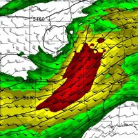
Look at all the tornado warnings across Florida today...126 in total. This is #2 all time for tornado warnings in a single state on a single calendar day, behind only Alabama's 134 tornado warnings on April 27, 2011, during the Super-Outbreak. What a day. #Milton

Nahel Belgherze (@wxnb_) 's Twitter Profile Photo

NHC Advisory 1 for Tropical Depression 14 had landfall only 12 miles north of where Milton eventually made landfall, at a 4-day lead time. One might say they're pretty good at their jobs.

Kathleen Schiro (@kathleenschiro) 's Twitter Profile Photo

Looking for a postdoc position, or know someone who is? Interested in cloud feedbacks? Mark Zelinka and I are recruiting for a project focused on high cloud feedbacks funded through the DOE RGMA program. Feel free to contact us for more information. Please share!