Nathaniel V. KELSO (@kelsoscorner) 's Twitter Profile
Nathaniel V. KELSO

@kelsoscorner

Map geek & cartographer. Prior @snap, @mapzen, @apple, @stamen, @washingtonpost, @nationalgeographic. See NaturalEarthData.com! Views my own, RT != +1.

ID: 107911169

linkhttp://kelsocartography.com/blog/ calendar_today24-01-2010 05:00:31

14,14K Tweet

5,5K Followers

3,3K Following

Levente Juhász (@juhaszlevi) 's Twitter Profile Photo

📜📢Hot off the press. Correctness Comparison of ChatGPT-4, Gemini, Claude-3, and Copilot for Spatial Tasks Since an #AI #chatbot powered by an #llm is not sci-fi anymore, we need to understand their #geospatial capabilities more. doi.org/10.1111/tgis.1… FIU GIS Center UF Geomatics at Fort Lauderdale

Nathaniel V. KELSO (@kelsoscorner) 's Twitter Profile Photo

Is there a setting in #qgis for macOS to adjust the DPI so it assumes 72 logical pixels instead of 96 (a Windows default)? Otherwise the reported scale is off. While adjusting the document's magnifier setting in bottom of window to 133% does kinda fix this, everything else is off

Nathaniel V. KELSO (@kelsoscorner) 's Twitter Profile Photo

Federal Appeals Court Finds Geofence Warrants Are “Categorically” Unconstitutional (probably headed to US Supreme Court, again) eff.org/deeplinks/2024…

Tim Wallace (@wallacetim) 's Twitter Profile Photo

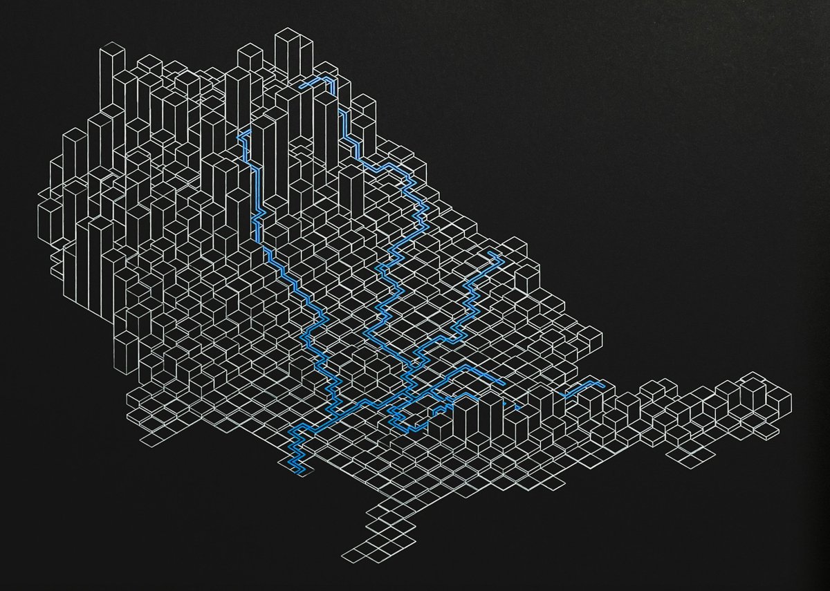
Just one of these left. Once it's gone, I'll move on to Mississippi River system elevation study II. timwallace.art/product/missis…

Just one of these left. Once it's gone, I'll move on to Mississippi River system elevation study II. timwallace.art/product/missis…
Jeff McKenna (@mapserving) 's Twitter Profile Photo

Happy 26th birthday to GDAL ! From the first commit on 1998-10-17 from a small rural town outside of Ottawa Canada, to almost every geospatial software installation on the planet (and satellites and other planets!) in 26 years. The ultimate example of sharing & community. #foss4g

Happy 26th birthday to GDAL ! From the first commit on 1998-10-17 from a small rural town outside of Ottawa Canada, to almost every geospatial software installation on the planet (and satellites and other planets!) in 26 years. The ultimate example of sharing & community. #foss4g
Tom Patterson (@mtnmapper) 's Twitter Profile Photo

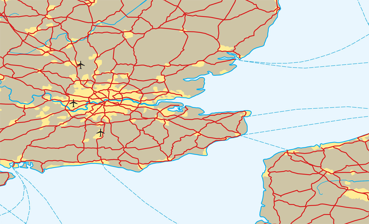
This morning @nacis we are announcing additions to the Natural Earth 6 dataset, including roads, ferry routes, and airports. A big thanks to ZHA0XU SUI for working on it. Get the beta data here: shadedrelief.com/ne-draft/
This morning @nacis we are announcing additions to the Natural Earth 6 dataset, including roads, ferry routes, and airports. A big thanks to <a href="/SuiZhaoxu/">ZHA0XU SUI</a> for working on it. Get the beta data here: shadedrelief.com/ne-draft/
Nathaniel V. KELSO (@kelsoscorner) 's Twitter Profile Photo

Slides for my NACIS prezi "Who’s On First: Ready for map display: shapefiles, choropleths, and labels" drive.google.com/file/d/1xi7wAU…

Nathaniel V. KELSO (@kelsoscorner) 's Twitter Profile Photo

East Sea / Sea of Japan, Persian Gulf / Arabian Gulf, and now we join the club with Gulf of Mexico / Gulf of America nytimes.com/2025/01/24/us/…

Applied Intuition (@appliedint) 's Twitter Profile Photo

Read our blog post to learn about Applied Intuition's approach to mapping: 🗺️ Hybrid mapping enhances ADAS functionality and scalability 🗺️ AI-powered mapping brings efficiency to data analysis 🗺️ 5G enables instant data transmission appliedintuition.com/blog/hybrid-ma… #mapping #adas

Applied Intuition (@appliedint) 's Twitter Profile Photo

Qasar Younis was on Bloomberg TV highlighting our Series F round, how Applied Intuition is bringing vehicle intelligence to every moving machine, and the future of AI-powered mobility. Watch the full segment here: bloomberg.com/news/videos/20… #seriesf #autonomy