
LiDARmag (@lidarmag) 's Twitter Profile
LiDARmag

@lidarmag

Official account for LiDAR Magazine! LiDAR magazine explores all things Geotech, LiDAR, UAV, UAS and earth imaging technology including drones! Est. 2010

ID: 3264708841

linkhttp://www.lidarmag.com calendar_today01-07-2015 18:12:19

953 Tweet

1,1K Followers

30 Following

ArcGIS StoryMaps (@arcgisstorymaps) 's Twitter Profile Photo

Landsat, the longest-running earth-observing satellite 🛰️ program in history, turned fifty this weekend! #Landsat50 See how USGS & NASA Landsat images provide a visual record of Earth’s changing landscapes. esri.social/Prv950K3zKo 📷: Colorado River Basin from 1998 to 2022

Simonetta Cheli (@simonettacheli) 's Twitter Profile Photo

We have just announced with the European Commission that the Copernicus EU #Sentinel1 B satellite can no longer deliver radar data. This were the conclusions of the Anomaly Review Board: esa.int/Applications/O…

We have just announced with the European Commission that the <a href="/CopernicusEU/">Copernicus EU</a> #Sentinel1 B satellite can no longer deliver radar data. 

This were the conclusions of the Anomaly Review Board: 
esa.int/Applications/O…
GIS Ambassador (@gisambassador) 's Twitter Profile Photo

Where do you place a rover? Where do Astronauts land? #GIS in #space? Oh yes! In this #career spotlight, Planetary Scientist, Dr. Bhairavi Shankar shares how GIS is used beyond earth: bit.ly/3bIMKil #Science #geography #STEMeducation #mentor Indus Space #scientist
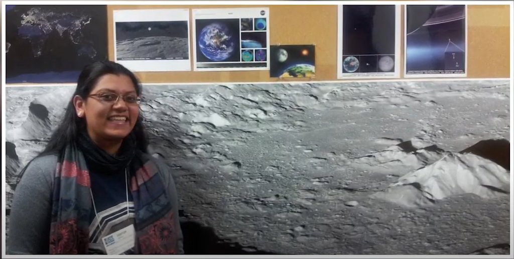
Where do you place a rover? Where do Astronauts land?
#GIS in #space? Oh yes!

In this #career spotlight, Planetary Scientist, Dr. Bhairavi Shankar shares how GIS is used beyond earth: bit.ly/3bIMKil

#Science #geography #STEMeducation #mentor <a href="/indusspaceCA/">Indus Space</a> #scientist
Esri Eastern Africa (@esriea) 's Twitter Profile Photo

Drones are changing how we work in practically every aspect, and the possibilities for their use are only limited by our creativity. Discover how you can turn drone imagery to geospatial intelligence. 👇 hubs.li/Q01jPyWm0 #ArcGIS #GEOINT #GIS

Drones are changing how we work in practically every aspect, and the possibilities for their use are only limited by our creativity. Discover how you can turn drone imagery to geospatial intelligence. 👇
hubs.li/Q01jPyWm0
#ArcGIS #GEOINT #GIS
Equator (@equatormaps) 's Twitter Profile Photo

The global LiDAR market size is expected to grow from $1.49 billion in 2021 to $1.77 billion in 2022. Take advantage of this trend and access the largest collection of LiDAR on Equator.

The global LiDAR market size is expected to grow from $1.49 billion in 2021 to $1.77 billion in 2022. 

Take advantage of this trend and access the largest collection of LiDAR on Equator.
Esri Partners (@esripartners) 's Twitter Profile Photo

Blue Raster Blue Raster uses #ArcGIS to help National Audubon Society launch Bird Migration Explorer. An interactive, digital platform that visualizes bird migration data across the western hemisphere. #EsriPartner esri.social/T0OA50KN165
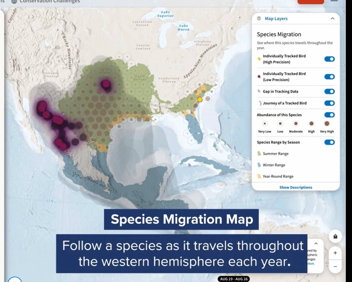
Blue Raster <a href="/blueraster/">Blue Raster</a> uses #ArcGIS to help National Audubon Society launch Bird Migration Explorer. An interactive, digital platform that visualizes bird migration data across the western hemisphere.  #EsriPartner

esri.social/T0OA50KN165
Hexagon AB (@hexagonab) 's Twitter Profile Photo

Now that the Mayflower Autonomous Ship has successfully completed its maiden voyage across the Atlantic, it's time to check out #HxGNRadio to learn what the project's team leads have to say about the voyage & what’s next for the project. hxgn.biz/3fX4qs0 #autonomous #tech

Now that the Mayflower Autonomous Ship has successfully completed its maiden voyage across the Atlantic, it's time to check out #HxGNRadio to learn what the project's team leads have to say about the voyage &amp; what’s next for the project. hxgn.biz/3fX4qs0 #autonomous #tech
LiDARmag (@lidarmag) 's Twitter Profile Photo

Mosaic X high resolution cameras, enabling customers to gather more valuable data with their mobile mapping solutions, now compatible with RIEGL’s line of Mobile Laser Scanning Systems. bit.ly/3T9fL6L

NOAA Digital Coast (@noaadigcoast) 's Twitter Profile Photo

You can download our #SeaLevelRise data and use it in your own viewer or maps. We have layers for 1 to 10 feet of Sea Level Rise. Get it here: coast.noaa.gov/digitalcoast/d… #ClimateChange

You can download our #SeaLevelRise data and use it in your own viewer or maps. We have layers for 1 to 10 feet of Sea Level Rise. Get it here: coast.noaa.gov/digitalcoast/d… #ClimateChange
LiDARmag (@lidarmag) 's Twitter Profile Photo

Amazing image of the day from NASA - the most powerful rocket in the world, carrying the Orion spacecraft launches on the Artemis I flight test, Wednesday, Nov. 16, 2022, from Launch Complex 39B at NASA’s Kennedy Space Center in Florida at 1:47 a.m. EST. go.nasa.gov/3Grv33P

Amazing image of the day from <a href="/NASA/">NASA</a> - the most powerful rocket in the world, carrying the Orion spacecraft launches on the Artemis I flight test, Wednesday, Nov. 16, 2022, from Launch Complex 39B at NASA’s Kennedy Space Center in Florida at 1:47 a.m. EST. go.nasa.gov/3Grv33P
Sentera (@senteraofficial) 's Twitter Profile Photo

What is Sentera’s new #DGRSystem? Adding onto compatible #agdrones, the DGR System saves hours at the field edge and in the office – giving more time for analysis and decision making. Get the details on how it works in our latest blog post: hubs.ly/Q01sGxSH0 #AgTech

Paul Taylor (@paultaylor43) 's Twitter Profile Photo

The 192.710 Calculator #ArcGISPro Add-In from @CHAcompanies provides gas transmission operators with a convenient and repeatable method to determine which #pipeline areas meet the 192.710 criteria. esri.social/oHO050M7k0c #EsriPartner #ArcGISmarketplace #infrastructure

The 192.710 Calculator #ArcGISPro Add-In from @CHAcompanies provides gas transmission operators with a convenient and repeatable method to determine which #pipeline areas meet the 192.710 criteria. esri.social/oHO050M7k0c  #EsriPartner #ArcGISmarketplace #infrastructure
USGIF (@usgif) 's Twitter Profile Photo

USGIF is accepting applications for student poster presentations at the 2023 GEOINT Symposium, May 21 - 24, in St. Louis, Missouri. Students at the undergraduate, graduate and Ph.D. levels are eligible to apply for the Student Poster Contest. Learn more at trajectorymagazine.com/geoint-2023-st…

LiDARmag (@lidarmag) 's Twitter Profile Photo

The Geospatial Data Act might get an amendment - Some interesting news. Lawmakers are planning to introduce an amendment to a landmark 2018 law that codified policies for sharing and using geospatial data. bit.ly/3Zu3EEB

Dr. Dawn Wright + @deepseadawn.bsky.social 🇺🇦 (@deepseadawn) 's Twitter Profile Photo

1/2 Going to the #EsriUC2023? We hope to see you at the #ScienceSymposium, Tues, Jul 11, 4:00, SDCC Ballroom 6DE, w/a keynote by the amazing Dr. Kelsey Leonard plus lots of free goodies more in next tweet!! ⤵️

1/2 Going to the #EsriUC2023? We hope to see you at the #ScienceSymposium, Tues, Jul 11, 4:00, SDCC Ballroom 6DE, w/a keynote by the amazing
<a href="/KelseyTLeonard/">Dr. Kelsey Leonard</a> plus lots of free goodies more in next tweet!! ⤵️