Miloslav Michalko (@m_michalko) 's Twitter Profile
Miloslav Michalko

@m_michalko

Geospatial data consultant & Researcher University of Prešov. PhD in regional science #opensourceGIS #QGIS #SDI

ID: 4166491516

linkhttp://geosupport.sk calendar_today11-11-2015 20:58:17

460 Tweet

109 Followers

285 Following

INSPIRE_EU (@inspire_eu) 's Twitter Profile Photo

INSPIRE Good Practices are approaches that facilitate & modernise data sharing in INSPIRE. A candidate Good Pratice is GeoPackage. If you are interested to see how it is integrated into the INSPIRE framework, don't miss the webinar on October 27: 🔗 europa.eu/!86rdjK


INSPIRE Good Practices are approaches that facilitate & modernise data sharing in INSPIRE.

A candidate Good Pratice is <a href="/GeoPackage1/">GeoPackage</a>. If you are interested to see how it is integrated into the INSPIRE framework, don't miss the webinar on October 27:

🔗 europa.eu/!86rdjK
Luna Geospatial, Inc. (@lunageospatial) 's Twitter Profile Photo

If you missed our webinar entitled QGIS, PostGIS, and Geoserver in an Enterprise Environment, the video is now online. lunageo.com/webinar/qgis-p…

If you missed our webinar entitled QGIS, PostGIS, and Geoserver in an Enterprise Environment, the video is now online. 

lunageo.com/webinar/qgis-p…
Copernicus EU (@copernicuseu) 's Twitter Profile Photo

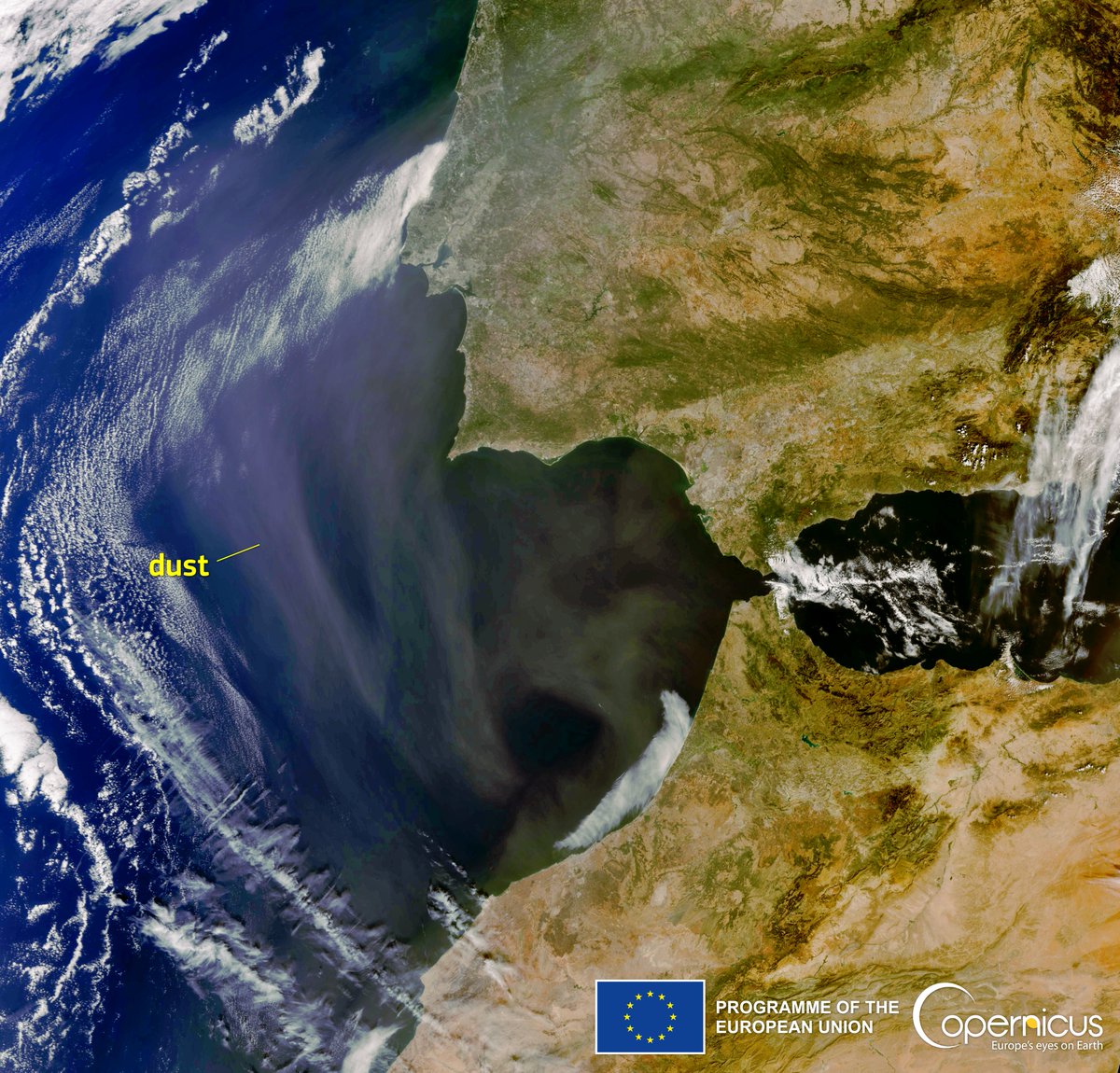
#Copernicus for #AirQuality monitoring For the fourth day in a row, a massive amount of #SaharanDust is pouring into the skies over the western Atlantic Ocean Dust over the southwestern part of the Iberian Peninsula 🇵🇹🇪🇸 and North Morocco 🇲🇦 as seen by #Sentinel3 🇪🇺🛰️ on 5 Oct.

#Copernicus for #AirQuality monitoring

For the fourth day in a row, a massive amount of #SaharanDust is pouring into the skies over the western Atlantic Ocean

Dust over the southwestern part of the Iberian Peninsula 🇵🇹🇪🇸 and North Morocco 🇲🇦 as seen by #Sentinel3 🇪🇺🛰️ on 5 Oct.
Mergin Maps (@merginmaps) 's Twitter Profile Photo

Read how #QGIS and Mergin Maps is used to simplify the waste sampling and analysis in Czech Republic: merginmaps.com/case-studies/w…

OpenStreetMap CZ (@osmcz) 's Twitter Profile Photo

WeeklyOSM 635: Místní názvy. Extrakce budov. Stromy v MapComplete. Obrázky v Commons. Hledání v denících. Indoor tagování. Statistiky ze SotM. Záplavy v Pákistánu. Deutsche Bahn. Hlukové mapy. ODbL a CC-BY. Editor Every Door. GraphHopper 6.0. JPG nebo PNG? weeklyosm.eu/cz/archives/15…

Miloslav Michalko (@m_michalko) 's Twitter Profile Photo

Proud to have a chapter in Stanley D. Brunn's book #COVID19andWorldOfAdHocGeographies. Thanks Jana Michalkova and Rado Klamar for the collaboration! "Measuring the Spread of COVID-19: Restrictions and Mobility in V4" (pp 1843–1863) link.springer.com/chapter/10.100…
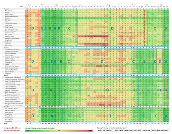
Proud to have a chapter in Stanley D. Brunn's book #COVID19andWorldOfAdHocGeographies. Thanks <a href="/j_michalkova/">Jana Michalkova</a> and Rado Klamar for the collaboration!
"Measuring the Spread of COVID-19: Restrictions and Mobility in V4" (pp 1843–1863)  link.springer.com/chapter/10.100…
NASA Webb Telescope (@nasawebb) 's Twitter Profile Photo

This is what you’ve waited for. Journey with us through Webb’s breathtaking view of the Pillars of Creation, where scores of newly formed stars glisten like dewdrops among floating, translucent columns of gas and dust: go.nasa.gov/3EPPiXW Here’s your guided tour ⬇️

This is what you’ve waited for.

Journey with us through Webb’s breathtaking view of the Pillars of Creation, where scores of newly formed stars glisten like dewdrops among floating, translucent columns of gas and dust: go.nasa.gov/3EPPiXW

Here’s your guided tour ⬇️
IGEO (CSIC-UCM) (@igeociencias) 's Twitter Profile Photo

Conoces este visor geológico mundial? Macrostrat.org con versión para móviles, ofrece una cartografía geológica además de las principales estructuras tectónicas a lo largo del globo terráqueo.

Missing Maps (@themissingmaps) 's Twitter Profile Photo

This project embraced the power of Participatory Geographic Information Systems and is yet another example of how open mapping, cooperation, skill-sharing, and local knowledge are essential to respond to development challenges. Read about it here👇youthmappers.org/post/youthmapp…

Jana Michalkova (@j_michalkova) 's Twitter Profile Photo

We invite all supporters of the QGIS project to the first informal user meeting of Slovak QGIS user group. Please register here: eventbrite.com/e/qgis-day-tic… See you in Bratislava 🙂

irdpmwanza youthmappers (@irdpmwanza) 's Twitter Profile Photo

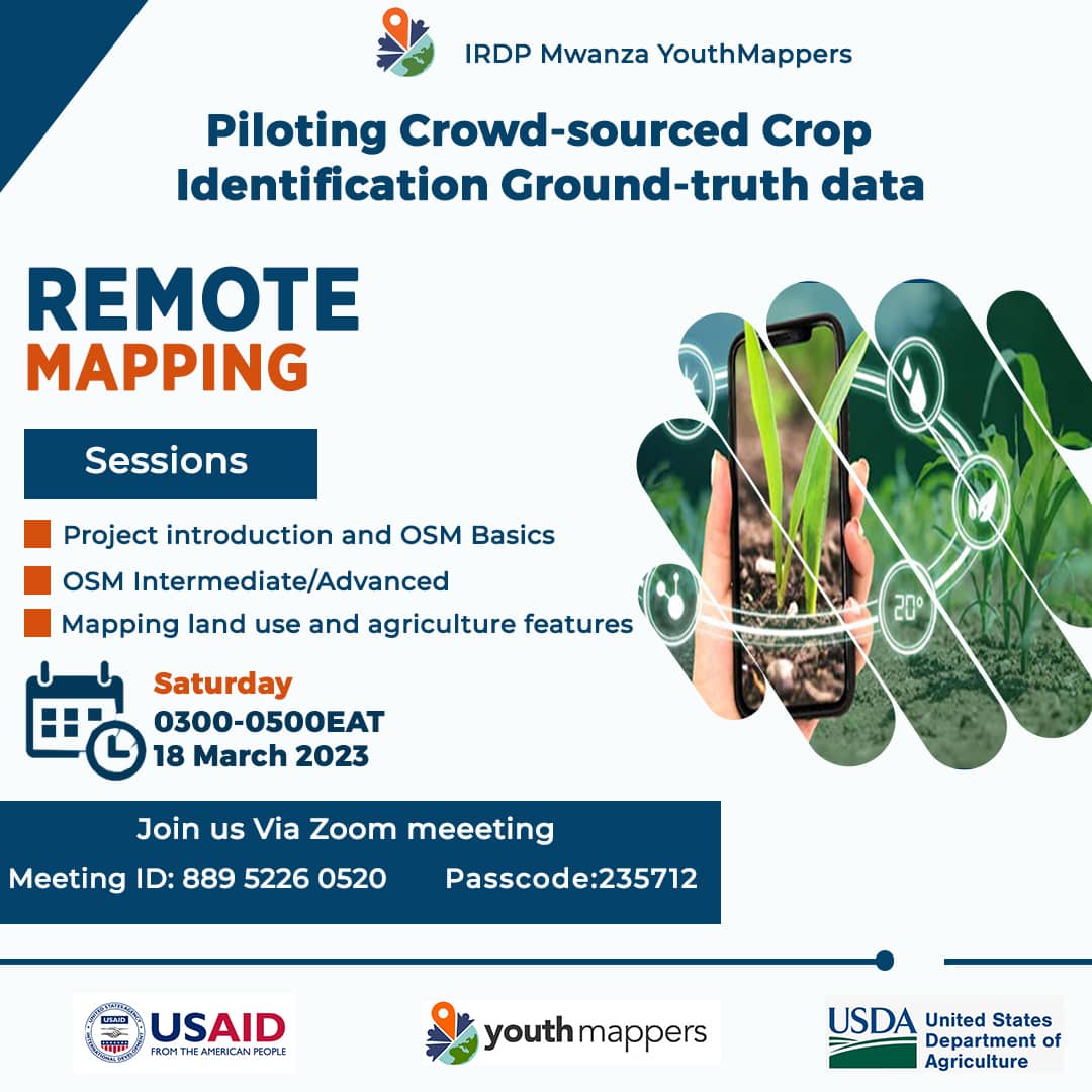
Dear Youth Mappers, GIS Enthusiasts, NGOs and other people who are interested in mapping you're most welcome to the Remote mapping training that will be conducted 18 March 2023 at IRDP-MWANZA, Kisesa Campus on 3:00pm EAT. Also, you can join through zoom meeting, Link on poster

Dear Youth Mappers, GIS Enthusiasts, NGOs and other people who are interested in mapping you're most welcome to the Remote mapping training that will be conducted 18 March 2023 at IRDP-MWANZA, Kisesa Campus on 3:00pm EAT.
Also, you can join through zoom meeting, Link on poster
Alasdair Rae (@undertheraedar) 's Twitter Profile Photo

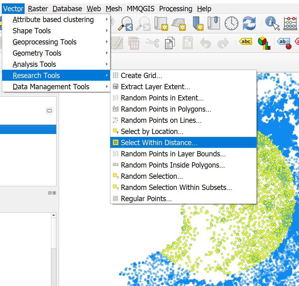
I hadn't noticed the Select Within Distance... addition to the Research Tools menu in QGIS until now but it will certainly save a few clicks

I hadn't noticed the Select Within Distance... addition to the Research Tools menu in QGIS until now but it will certainly save a few clicks
Marco Minghini (@marcominghini) 's Twitter Profile Photo

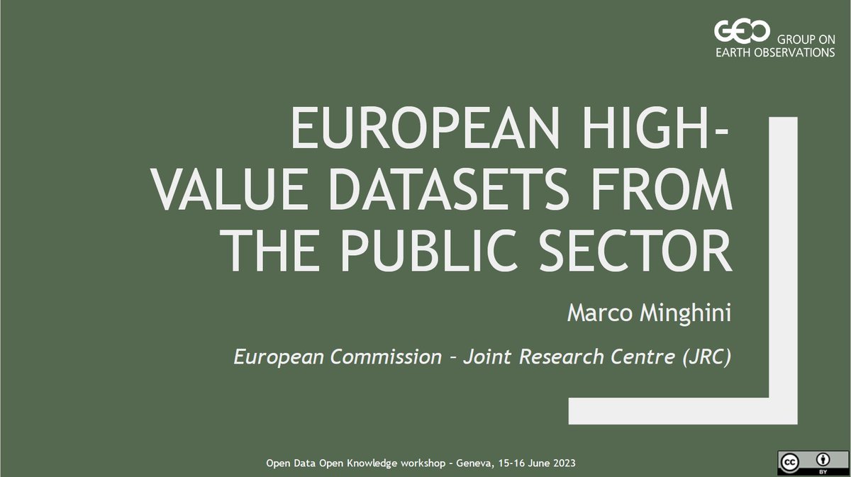
Slides of my #ODOK2023 talk on European high-value datasets, and how 🇪🇺 lessons learnt can be useful to GEO activities & guidelines on open data licensing, are available at github.com/MarcoMinghini/… PS aligned with the GEO Data Licensing Guidance, license is CC BY 4.0 😉

Slides of my #ODOK2023 talk on European high-value datasets, and how 🇪🇺 lessons learnt can be useful to GEO activities &amp; guidelines on open data licensing, are available at github.com/MarcoMinghini/…

PS aligned with the GEO Data Licensing Guidance, license is CC BY 4.0 😉
Said Turksever (@asturksever) 's Twitter Profile Photo

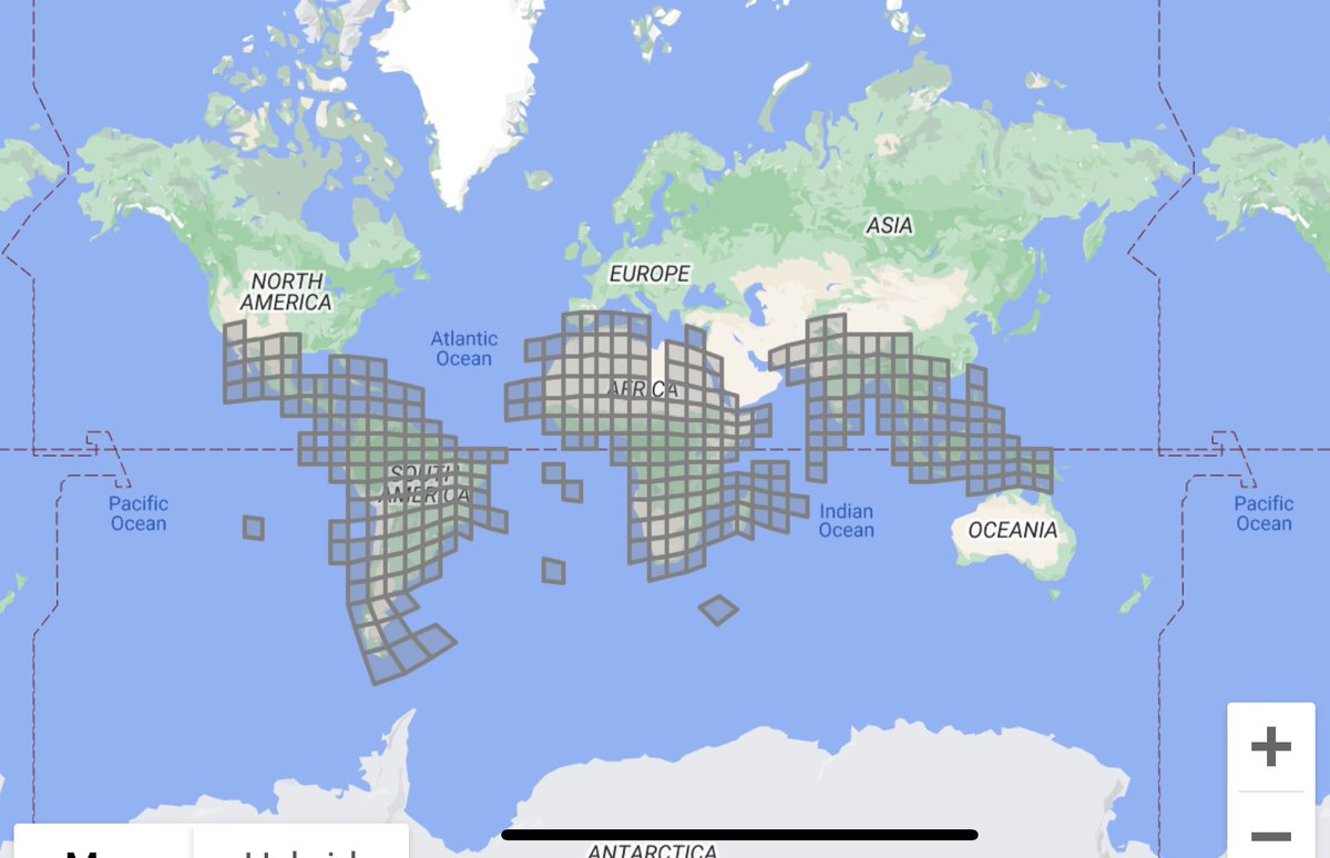
This is awesome! Google shared Open Building datasets with CC BY-4.0 and ODbL v1.0 licenses. It would be interesting to compare this dataset with Microsoft’s building dataset. sites.research.google/open-buildings

This is awesome! <a href="/Google/">Google</a> shared Open Building datasets with CC BY-4.0 and ODbL v1.0 licenses.

It would be interesting to compare this dataset with <a href="/Microsoft/">Microsoft</a>’s building dataset. 

sites.research.google/open-buildings
Jana Michalkova (@j_michalkova) 's Twitter Profile Photo

Join us and contribute to a better tomorrow #osmgeoweek! We will be mapping (in hybrid format) the missing buildings in the #Prešov region for better decision-making. Register here: forms.gle/rwTFXWJYKv824v… YouthMappers 𝗨𝗡𝗜𝗣𝗢 𝗠𝗮𝗽𝗽𝗲𝗿𝘀 🌍 OpenStreetMap #teachosm FreemapSlovakia
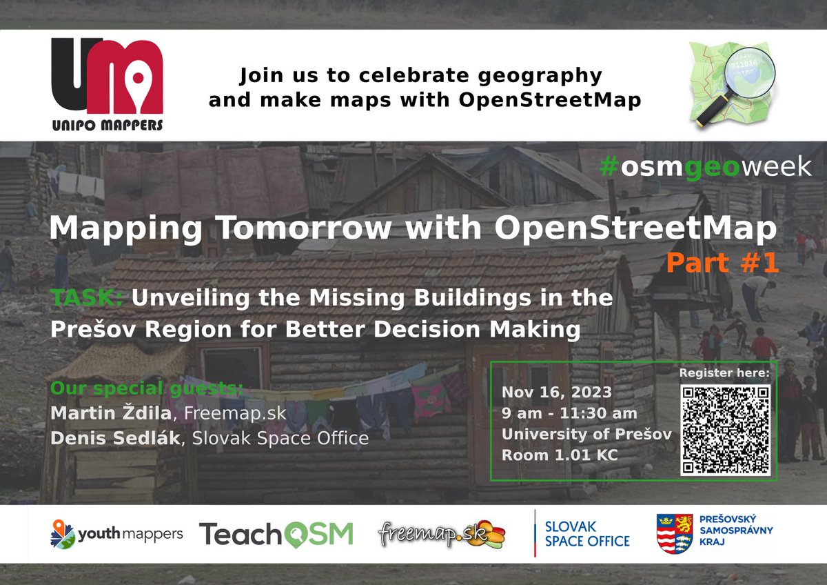

Join us and contribute to a better tomorrow #osmgeoweek! We will be mapping (in hybrid format) the missing buildings in the #Prešov region for better decision-making.
Register here: forms.gle/rwTFXWJYKv824v…
<a href="/youthmappers/">YouthMappers</a>  <a href="/unipo_mappers/">𝗨𝗡𝗜𝗣𝗢 𝗠𝗮𝗽𝗽𝗲𝗿𝘀 🌍</a> <a href="/openstreetmap/">OpenStreetMap</a> #teachosm <a href="/FreemapSlovakia/">FreemapSlovakia</a>