Gannon Medwick (@medwick) 's Twitter Profile
Gannon Medwick

@medwick

Chief Meteorologist (CBM 573), WECT, Wilmington, NC... Wilmington, DE native... PSU ‘03... Eastern NC life, family, work since ‘04... #FlyEaglesFly 🦅

ID: 39058849

linkhttp://www.wect.com/weather calendar_today10-05-2009 15:07:37

10,10K Tweet

5,5K Followers

1,1K Following

Gannon Medwick (@medwick) 's Twitter Profile Photo

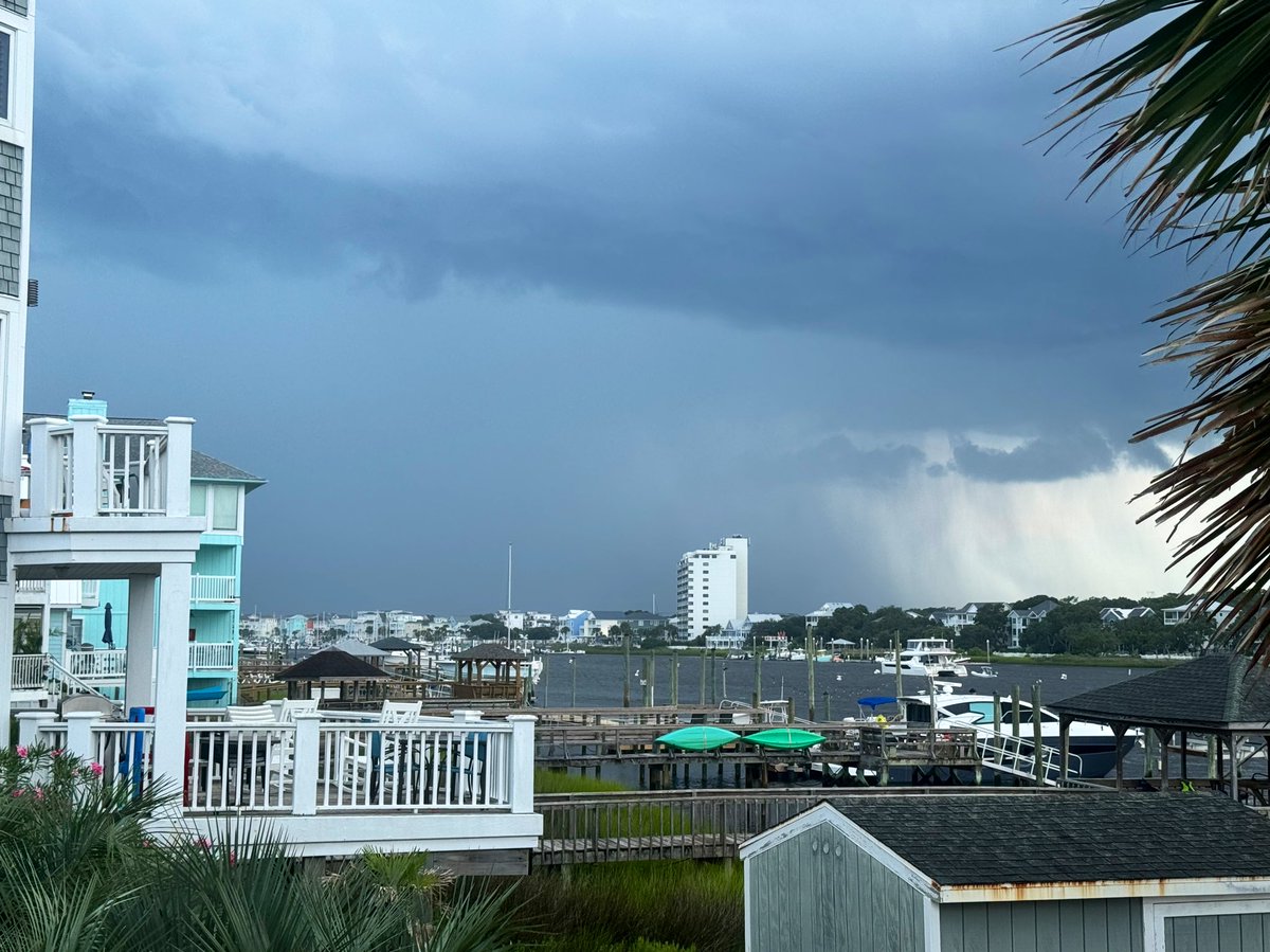
Another morning with spotty, "garden variety" showers and downpours... The shower / storm chance will have migrated well inland this afternoon and evening.

Gannon Medwick (@medwick) 's Twitter Profile Photo

Heat bulletins from the National Weather Service seem likely in this stretch. Be sure to keep up with them with your WECT Weather App, and take care of yourself, your people and your pets!

Heat bulletins from the National Weather Service seem likely in this stretch. Be sure to keep up with them with your WECT Weather App, and take care of yourself, your people and your pets!
Gannon Medwick (@medwick) 's Twitter Profile Photo

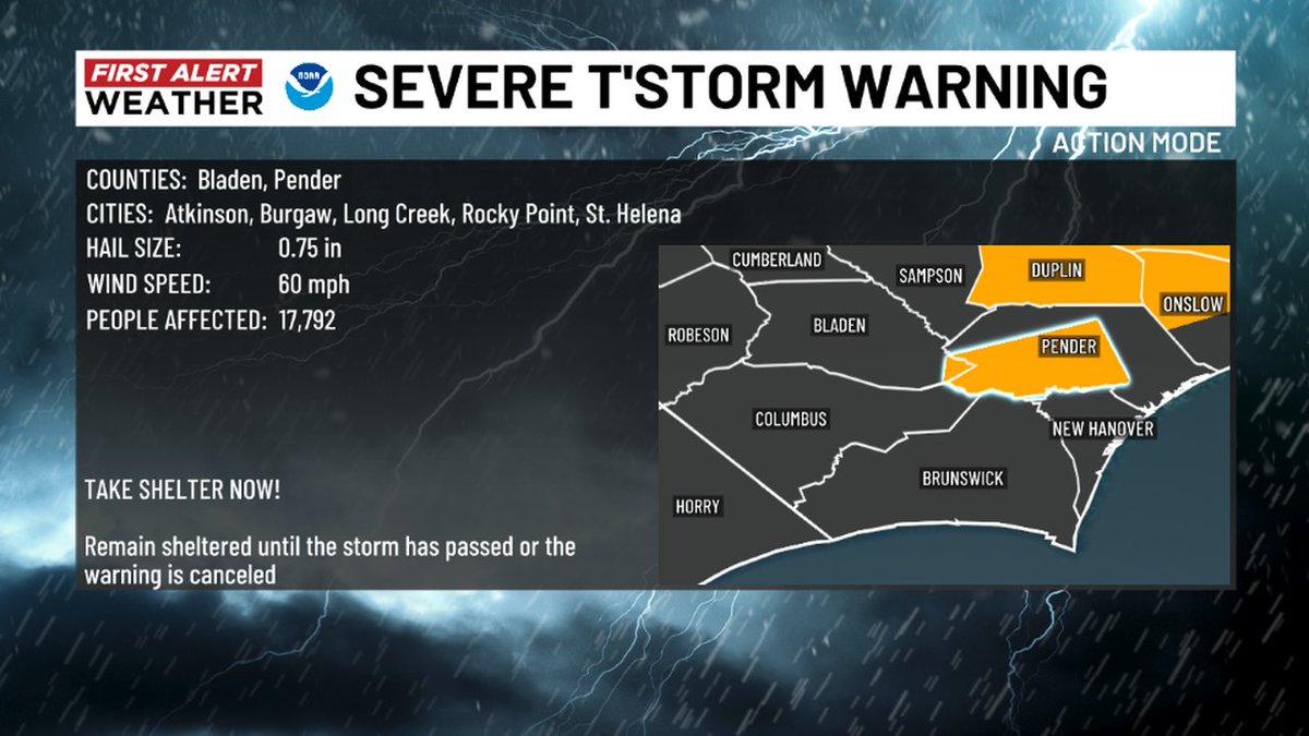
The National Weather Service has issued a Severe Thunderstorm Warning for the highlighted area. Please seek shelter in a sturdy structure until the storm passes and continue to stay alert with your WECT Weather App. RADAR: wect.com/weather #WECTwx #ILMwx

The National Weather Service has issued a Severe Thunderstorm Warning for the highlighted area. Please seek shelter in a sturdy structure until the storm passes and continue to stay alert with your WECT Weather App.
RADAR: wect.com/weather
#WECTwx #ILMwx
Gannon Medwick (@medwick) 's Twitter Profile Photo

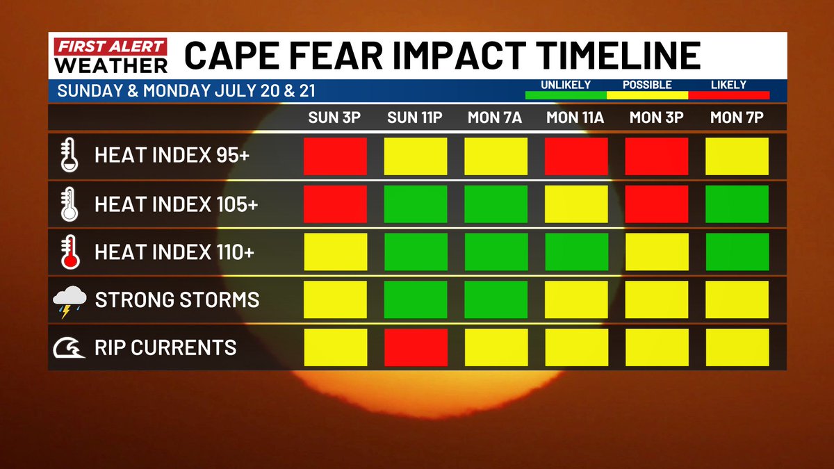
First Alert Weather Days continue Sunday and Monday for intense heat and a chance for strong storms (low chance Sunday, higher chance Monday). The heat index will be loathed to fall below 95 - even in the night!

First Alert Weather Days continue Sunday and Monday for intense heat and a chance for strong storms (low chance Sunday, higher chance Monday). The heat index will be loathed to fall below 95 - even in the night!
Gannon Medwick (@medwick) 's Twitter Profile Photo

A little cooler this Wednesday morning; some spots in the 60s on the mainland! Your First Alert Forecast called for this slight heat reprieve. Soak it in, because sizzling temps will make a big comeback this weekend!

A little cooler this Wednesday morning; some spots in the 60s on the mainland! Your First Alert Forecast called for this slight heat reprieve. Soak it in, because sizzling temps will make a big comeback this weekend!
Gannon Medwick (@medwick) 's Twitter Profile Photo

Spotty showers and downpours will slowly shift from the coast this morning to north / inland this afternoon. With highs in the 80s to around 90, today will be the coolest day of the next several by far.

Gannon Medwick (@medwick) 's Twitter Profile Photo

Please look out for your crew! Heat exhaustion is the warning shot for heat stroke - which can have lasting consequences. The very young, the very old, those who have to work in the heat, and those with pre-existing health conditions are most vulnerable. Rest and hydrate!

Please look out for your crew! Heat exhaustion is the warning shot for heat stroke - which can have lasting consequences. The very young, the very old, those who have to work in the heat, and those with pre-existing health conditions are most vulnerable. Rest and hydrate!
Gannon Medwick (@medwick) 's Twitter Profile Photo

The National Weather Service has issued a Severe Thunderstorm Warning for the highlighted area. Please seek shelter in a sturdy structure until the storm passes and continue to stay alert with your WECT Weather App. RADAR: wect.com/weather #WECTwx #ILMwx

The National Weather Service has issued a Severe Thunderstorm Warning for the highlighted area. Please seek shelter in a sturdy structure until the storm passes and continue to stay alert with your WECT Weather App.
RADAR: wect.com/weather
#WECTwx #ILMwx
Gannon Medwick (@medwick) 's Twitter Profile Photo

Our in-house model is bullish on storm redevelopment this Tuesday afternoon, so keep your WECT Weather App handy! Storms will offer localized heat relief. Otherwise, expect only a marginal roll-back in heat through midweek. (More substantial cooling seems likely this weekend!)

Our in-house model is bullish on storm redevelopment this Tuesday afternoon, so keep your WECT Weather App handy! Storms will offer localized heat relief. Otherwise, expect only a marginal roll-back in heat through midweek. (More substantial cooling seems likely this weekend!)
Gannon Medwick (@medwick) 's Twitter Profile Photo

Beyond any popup storms this Tuesday, a slow cold front will collect more storm chances in the next several days. There is some question to whether the front passes more cleanly than currently projected for this weekend; either case would result in much cooler temps!

Beyond any popup storms this Tuesday, a slow cold front will collect more storm chances in the next several days. There is some question to whether the front passes more cleanly than currently projected for this weekend; either case would result in much cooler temps!
Gannon Medwick (@medwick) 's Twitter Profile Photo

Got storms? The most electric ones are over the Grand Strand; First Alert as they're headed for southwestern Brunswick County after lunch.