Minnesota Geological Survey (@mn_geo_survey) 's Twitter Profile
Minnesota Geological Survey

@mn_geo_survey

Supporting the stewardship of water, land, and mineral resources in Minnesota by providing geoscience information.

ID: 1575503501823823872

linkhttps://cse.umn.edu/mgs calendar_today29-09-2022 15:12:31

96 Tweet

100 Followers

65 Following

Minnesota Geological Survey (@mn_geo_survey) 's Twitter Profile Photo

Click to learn about an ongoing airborne #geophysical #survey conducted by the USGS, MGS & other #Minnesota agencies - Natural Resources Research Institute at UMN, Minnesota DNR, & USGS Minerals. This work will help us better understand the #criticalmineral commodities in the region. usgs.gov/news/national-…
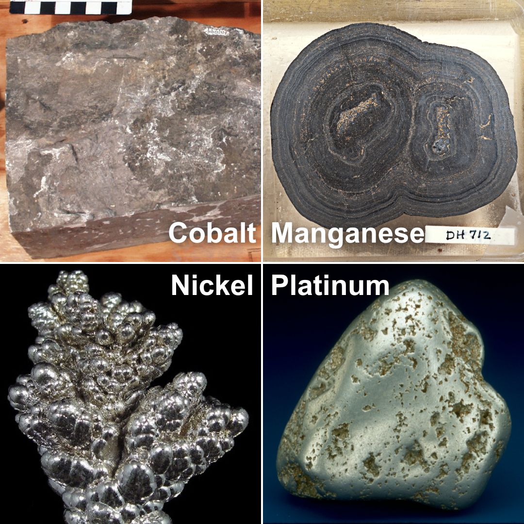
Click to learn about an ongoing airborne #geophysical #survey conducted by the <a href="/USGS/">USGS</a>, MGS &amp; other #Minnesota agencies - <a href="/UMDNRRI1/">Natural Resources Research Institute at UMN</a>, <a href="/mndnr/">Minnesota DNR</a>, &amp; <a href="/USGSMinerals/">USGS Minerals</a>. This work will help us better understand the #criticalmineral commodities in the region.
usgs.gov/news/national-…
Minnesota Geological Survey (@mn_geo_survey) 's Twitter Profile Photo

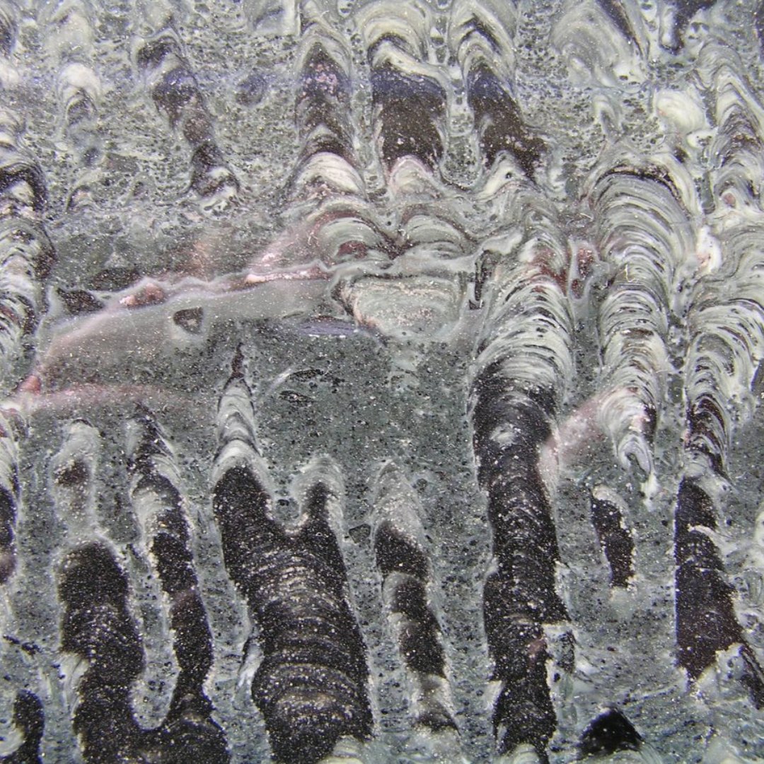
Happy #FossilFriday! We are diving into Minnesota's rich geological history with a glimpse at some remarkable finds: 1. Cretaceous fossil ammonites in shale 2. Ordovician bedrock gastropod shells 3. Cretaceous bedrock shark tooth 4. Paleoproterozoic bedrock stromatolites

Happy #FossilFriday! We are diving into Minnesota's rich geological history with a glimpse at some remarkable finds:

1. Cretaceous fossil ammonites in shale
2. Ordovician bedrock gastropod shells
3. Cretaceous bedrock shark tooth
4. Paleoproterozoic bedrock stromatolites
Minnesota Geological Survey (@mn_geo_survey) 's Twitter Profile Photo

We had so much fun at Laura Jeffrey Academy! 5th and 6th grade scholars analyzed data to create their own geologic maps of Minnesota. They also discovered how to use dilute hydrochloric acid to identify certain rocks! Laura Jeffrey Academy #LJARocks

Minnesota Geological Survey (@mn_geo_survey) 's Twitter Profile Photo

New publication alert! Available for download below. OFR-23-1: GEOPHYSICAL AND PETROLOGIC INVESTIGATIONS OF INVERSELY CORRELATED AEROMAGNETIC AND BOUGUER GRAVITY ANOMALIES WITHIN PRECAMBRIAN GNEISS TERRANE NEAR GARVIN, SOUTHWESTERN MINNESOTA hdl.handle.net/11299/256104

Minnesota Geological Survey (@mn_geo_survey) 's Twitter Profile Photo

New publication alert! Available for download below. RI 73: GEOPHYSICAL AND PETROLOGIC ADVANCES IN UNDERSTANDING THE TAUNTON-BELT WEDGE, AN ARCHEAN TERRANE WITHIN THE MINNESOTA RIVER VALLEY SUBPROVINCE OF THE SUPERIOR CRATON, NORTH-CENTRAL U.S.A hdl.handle.net/11299/256179

Minnesota Geological Survey (@mn_geo_survey) 's Twitter Profile Photo

Check out the new Lake #CountyGeologicAtlas Story Map! This story map is jam-packed with information about the #geology of Lake County, including oodles of images and fun interactive tools. arcg.is/1rCmT40 MN ENRTF

Wisconsin Geological & Natural History Survey (@wgnhs) 's Twitter Profile Photo

About a year ago, we released a publication showing the famous Driftless Area of Wisconsin! This publication was written by #WGNHS geologist Eric Carson with authors from Iowa Geological Society, Illinois State Geological Survey, and Minnesota Geological Survey. #ICYMI, learn more here! doi.org/10.54915/qapq2…
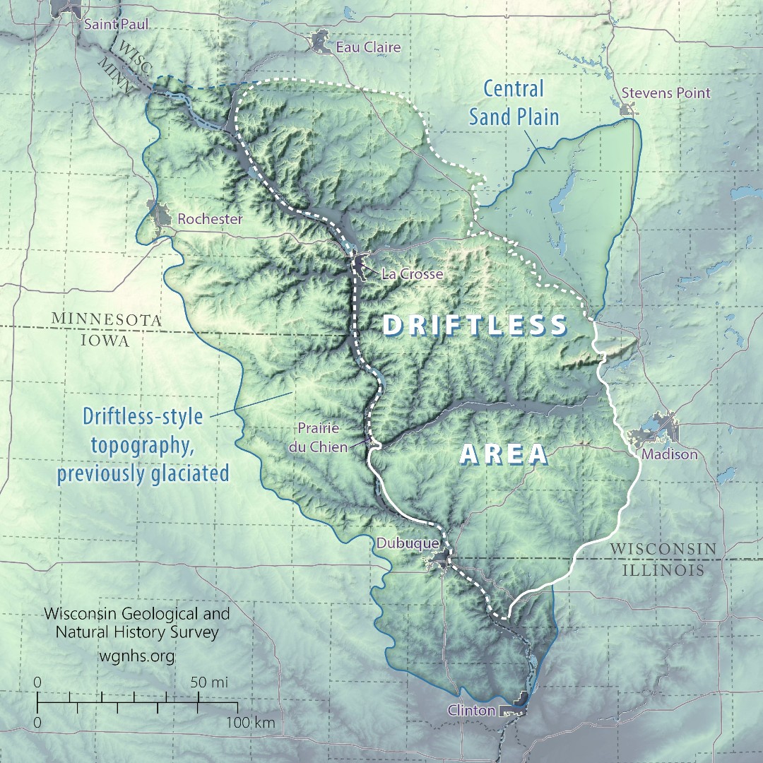
About a year ago, we released a publication showing the famous Driftless Area of Wisconsin! This publication was written by #WGNHS geologist Eric Carson with authors from Iowa Geological Society, <a href="/ILGeoSurvey/">Illinois State Geological Survey</a>, and <a href="/mn_geo_survey/">Minnesota Geological Survey</a>.

#ICYMI, learn more here!
doi.org/10.54915/qapq2…
Minnesota Geological Survey (@mn_geo_survey) 's Twitter Profile Photo

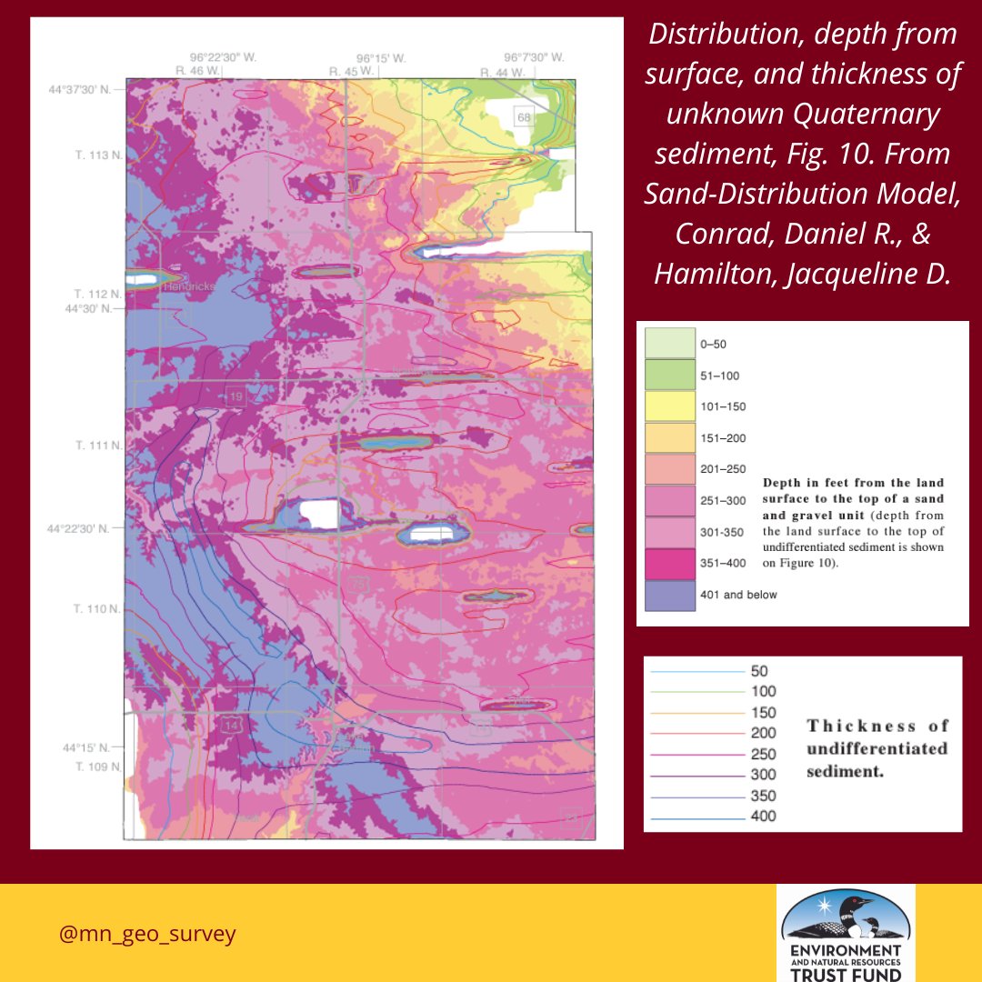
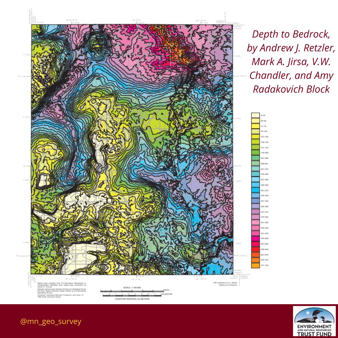
Make sure you check out the brand new, Part A County Geologic Atlas of Lincoln County! All plates for this recently published CGA are available to download on the #UMN Digital Conservancy: hdl.handle.net/11299/260212 Funding provided by MN ENRTF

Make sure you check out the brand new, Part A County Geologic Atlas of Lincoln County! All plates for this recently published CGA are available to download on the #UMN Digital Conservancy: hdl.handle.net/11299/260212

Funding provided by <a href="/mnenrtf/">MN ENRTF</a>
Minnesota Geological Survey (@mn_geo_survey) 's Twitter Profile Photo

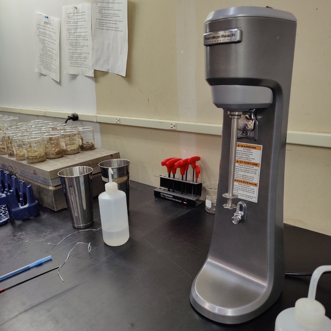
Today kicked off a unique start for our new sediment mixer at the Minnesota Geological Survey! Intended to be used for breaking down sediment samples for texture and compositional analysis, we first had to test its capabilities in a lighter, more flavorful context—milkshakes!

Today kicked off a unique start for our new sediment mixer at the Minnesota Geological Survey! Intended to be used for breaking down sediment samples for texture and compositional analysis, we first had to test its capabilities in a lighter, more flavorful context—milkshakes!
Minnesota Geological Survey (@mn_geo_survey) 's Twitter Profile Photo

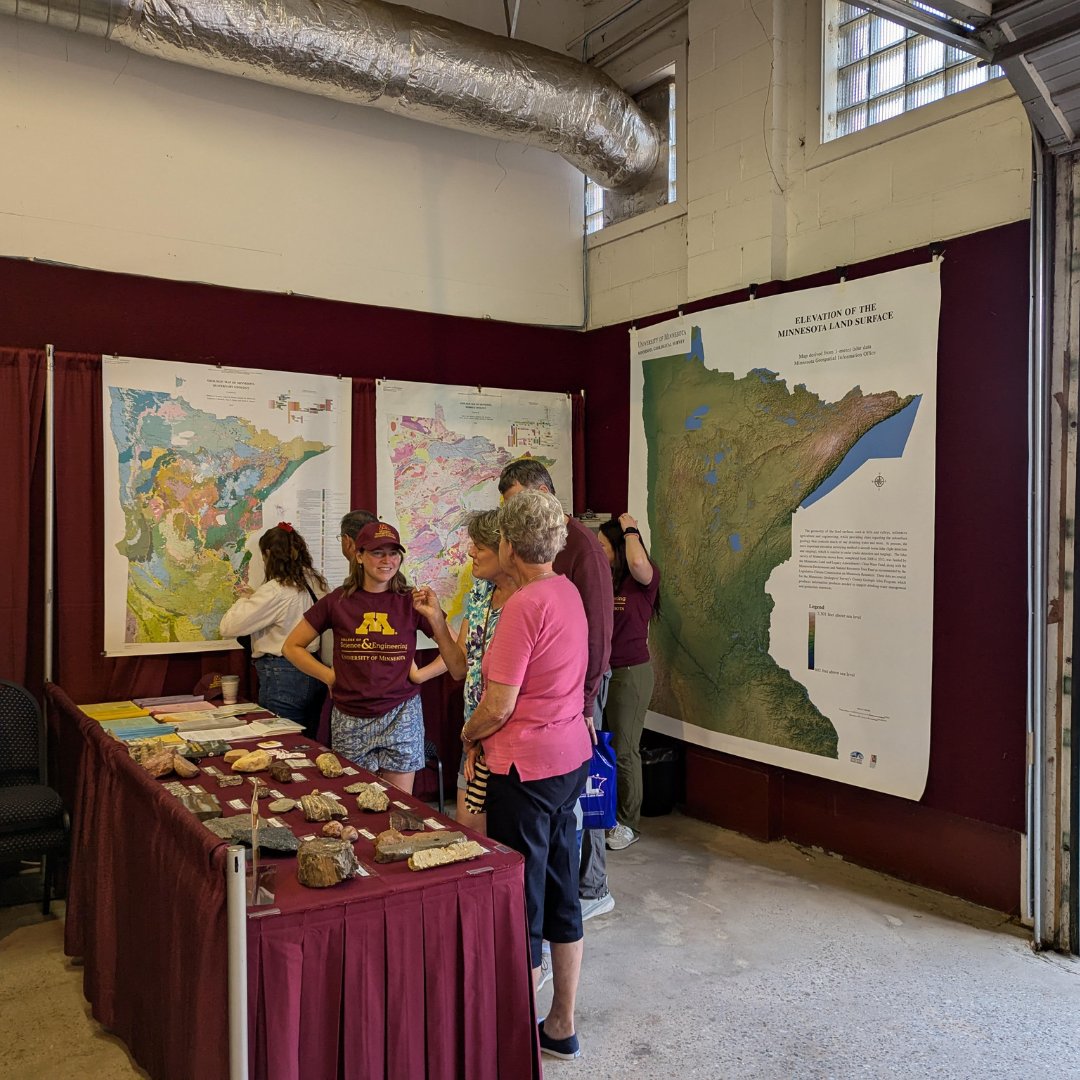
The Minnesota Geological Survey will be at the Minnesota State Fair this Thursday (8/22), at the UMN building! Come dive into Minnesota’s geology with our maps, explore fascinating rocks, chat with our geologists, and snag some free stickers and handouts!
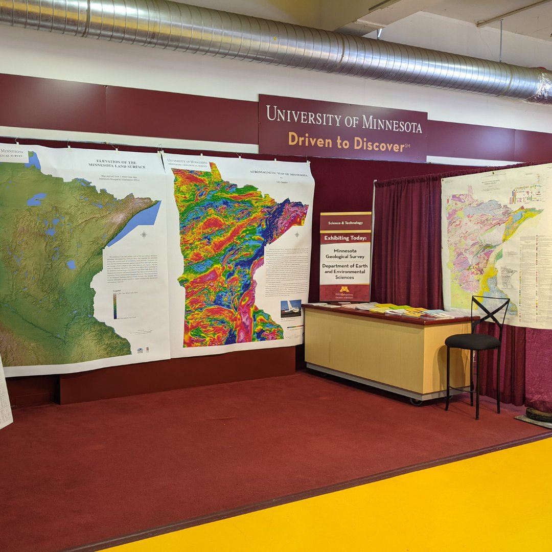
The Minnesota Geological Survey will be at the <a href="/mnstatefair/">Minnesota State Fair</a> this Thursday (8/22), at the UMN building! Come dive into Minnesota’s geology with our maps, explore fascinating rocks, chat with our geologists, and snag some free stickers and handouts!
Minnesota Geological Survey (@mn_geo_survey) 's Twitter Profile Photo

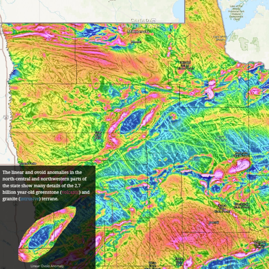
Explore the hidden depths of Minnesota’s geology with the Aeromagnetic Database! Learn how airborne magnetic data has revealed critical insights into the bedrock composition and structure. mngs-umn.opendata.arcgis.com/apps/507501adc…

Explore the hidden depths of Minnesota’s geology with the Aeromagnetic Database! Learn how airborne magnetic data has revealed critical insights into the bedrock composition and structure.

mngs-umn.opendata.arcgis.com/apps/507501adc…
Minnesota Geological Survey (@mn_geo_survey) 's Twitter Profile Photo

This fall, the USGS will begin collecting new high-resolution geophysical data over the Sioux Falls area, covering portions of South Dakota, Minnesota, and Iowa. Our geologists are so excited to see the results. tinyurl.com/mvchemdy

This fall, the <a href="/USGS/">USGS</a> will begin collecting new high-resolution geophysical data over the Sioux Falls area, covering portions of South Dakota, Minnesota, and Iowa. Our geologists are so excited to see the results. tinyurl.com/mvchemdy
Minnesota Geological Survey (@mn_geo_survey) 's Twitter Profile Photo

Explore the hidden depths of Minnesota’s geology with the gravity database! Learn how gravity anomalies have revealed critical insights into bedrock density, composition, and structure. mngs-umn.opendata.arcgis.com/apps/1a7908216…

Minnesota Geological Survey (@mn_geo_survey) 's Twitter Profile Photo

Make sure you check out the brand new, Part A County Geologic Atlas of Pipestone County! All plates for this recently published CGA are available to download on the #UMN Digital Conservancy: hdl.handle.net/11299/265725 Funding provided by MN ENRTF

Make sure you check out the brand new, Part A County Geologic Atlas of Pipestone County! All plates for this recently published CGA are available to download on the #UMN Digital Conservancy: hdl.handle.net/11299/265725

Funding provided by <a href="/mnenrtf/">MN ENRTF</a>