MNStorm
@mn_storm
Severe/fire weather enthusiast. Meteorology student at SCSU.
ID: 1304921001780752384
12-09-2020 23:13:52
6,6K Tweet
1,1K Followers
284 Following
 's Twitter Profile Photo")
 on Twitter photo One of the fires in NW Spain is producing a 8-10 km tall plume per radar.")
 on Twitter photo Radar echo tops are reaching 12-14 km from this wildfire west of Ponferrada. This is reaching PyroCb status.")
 's Twitter Profile Photo")
 's Twitter Profile Photo")
 's Twitter Profile Photo")
 on Twitter photo Más pirocúmulos del #IFJarilla vistos desde Puerto de Béjar (Salamanca) a las 20:00")
 's Twitter Profile Photo")
 on Twitter photo Mentioned HDWI (Hot Dry Windy Index) earlier.
Here the forecasted percentiles for several sites across #SoCal. You can see 90th/95th percentile forecasts. If a fire does ignite Thu-Sat, it has the potential to grow/spread very quickly.")
 's Twitter Profile Photo")
 's Twitter Profile Photo")
This wildfire season is already far more destructive than usual - with burnt areas several times above average across the #EUCivilProtection Mechanism countries. 📊 Data: Copernicus EMS
 on Twitter photo This wildfire season is already far more destructive than usual - with burnt areas several times above average across the #EUCivilProtection Mechanism countries.
📊 Data: <a href=\"/CopernicusEMS/\">Copernicus EMS</a>")
 's Twitter Profile Photo")
 's Twitter Profile Photo")
 's Twitter Profile Photo")
 on Twitter photo #CoyoteFire The Fire is 60 acres, Moderate Rate of Spread, Established on the North side, ongoing Torching and Spotting.
Evacuation Warning Areas Affected - East of Somerset, Omo Ranch, Omo Ranch Road, Farnham Ridge Road.
Cal Fire Intel 461 is overhead.")
 's Twitter Profile Photo")
 's Twitter Profile Photo")
 on Twitter photo <a href=\"/mn_storm/\">MNStorm</a> wow")
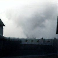
 on Twitter photo Some weak rotation is now visible on radar. #DollarLakeFire")
 's Twitter Profile Photo")
1-minute #GOES18/#GOESWest Infrared images (combined with the Fire Mask derived product) showed that the #DollarLakeFire in northwest Wyoming produced a notable #pyrocumulonimbus cloud (shades of blues to reds) that drifted E across the state. NWS Riverton #WYwx