Nadine Alameh (also @thenadinesa.bsky.social) (@nadinesa) 's Twitter Profile
Nadine Alameh (also @thenadinesa.bsky.social)

@nadinesa

Executive Director @TaylorGeoSTL | ex-CEO @opengeospatial| Alum @MIT | Geo Innovation & Partnerships for Impact | Instructor @Jazzercise | Single mom

ID: 26512087

linkhttps://www.linkedin.com/in/nadinealameh/ calendar_today25-03-2009 14:50:38

3,3K Tweet

2,2K Followers

1,1K Following

developmentseed (@developmentseed) 's Twitter Profile Photo

Just published our latest blog on Geospatial Foundation Models - powerful tools that are making satellite imagery more accessible and actionable. We share our learnings on how these models can accelerate your geospatial applications, from rapid similarity search to streamlined

Just published our latest blog on Geospatial Foundation Models - powerful tools that are making satellite imagery more accessible and actionable.

We share our learnings on how these models can accelerate your geospatial applications, from rapid similarity search to streamlined
Auren Hoffman (@auren) 's Twitter Profile Photo

“We used to say 80 percent of a data scientist’s job is data cleaning. I feel like that’s gone up to 90 plus percent.” – dj patil how much of your data science job is cleaning up messy data ... (in my experience 90+ percent feels right)

TaylorGeospatial (@taylorgeostl) 's Twitter Profile Photo

#ESIP Meeting starts tomorrow! Join Marge Cole and Rachel Opitz from #TGI as they present the #GeospatialInnovation for #FoodSecurity (#GIFS) program on Jan 24, 11:00 AM EST Nadine Alameh (also @thenadinesa.bsky.social) Registr: tinyurl.com/y2tusf6d

TaylorGeospatial (@taylorgeostl) 's Twitter Profile Photo

Join us for the Geospatial Innovation for Food Security Workshop in St. Louis in 2 weeks! Explore how #geospatial can address #foodsecurity & create #resilient #foodsystems. Learn more: taylorgeospatial.org/foodsecuritych… Nadine Alameh (also @thenadinesa.bsky.social) #GeospatialInnovation #TGIEvent

TaylorGeospatial (@taylorgeostl) 's Twitter Profile Photo

Join us at #GIFS #workshop on Feb 6 to explore how #geospatial tools are shaping #sustainablefarming and #landmanagement. Details here: taylorgeospatial.org/foodsecuritych… #foodsecurity #paneldiscussion #TGIevent Nadine Alameh (also @thenadinesa.bsky.social)

Join us at #GIFS #workshop on Feb 6 to explore how #geospatial tools are shaping #sustainablefarming and #landmanagement. Details here: taylorgeospatial.org/foodsecuritych…  #foodsecurity #paneldiscussion #TGIevent <a href="/nadinesa/">Nadine Alameh (also @thenadinesa.bsky.social)</a>
TaylorGeospatial (@taylorgeostl) 's Twitter Profile Photo

#Geospatial innovators are using #GenerativeAI to build future! Join TGI's #GeoAI Working Group Feb 6 at 2 pm CT. Phil Cooper Amazon Web Services, Sacha Lepretre LuxCarta, Jesse Kallman Danti 👉 Link: lnkd.in/gzhDvNQJ Nadine Alameh (also @thenadinesa.bsky.social) Meeting ID: 843 369 6426 | Password: 0Xn88U


#Geospatial innovators are using #GenerativeAI to build future! Join TGI's #GeoAI Working Group Feb 6 at 2 pm CT. Phil Cooper <a href="/awscloud/">Amazon Web Services</a>, Sacha Lepretre <a href="/LuxCarta/">LuxCarta</a>, Jesse Kallman <a href="/danti_ai/">Danti</a> 
👉 Link: lnkd.in/gzhDvNQJ <a href="/nadinesa/">Nadine Alameh (also @thenadinesa.bsky.social)</a> 
Meeting ID: 843 369 6426 | Password: 0Xn88U
NASAEarthdata (@nasaearthdata) 's Twitter Profile Photo

Registration is still open: NASA Earth data training webinar Wed. 1/29, 2PM EST (-05:00 UTC). Topic: Learn how to work with TROPICS, MERRA-2, and LDAS datasets to investigate the record-setting Hurricane Milton. #GESDISC To register: go.nasa.gov/3E1vjag

TaylorGeospatial (@taylorgeostl) 's Twitter Profile Photo

The #GeospatialRiskSummit is almost here! Join TGI's Rachel Opitz & Marge Cole Marge Cole from #TGI in #NewYork on Jan 29-30 to explore how #geospatialtech is transforming #riskmanagement and tackling #climaterisks. Nadine Alameh (also @thenadinesa.bsky.social) 👉geospatialrisk.com

TaylorGeospatial (@taylorgeostl) 's Twitter Profile Photo

Join the TGI #GIFS Challenge to explore how #geospatialtechnologies can help reduce #foodwaste and improve #nutrition and #foodsecurity Date: Feb 6, 2025 Details: taylorgeospatial.org/foodsecuritych… #agriculture #GeospatialInnovation Rachel Opitz Nadine Alameh (also @thenadinesa.bsky.social)

Join the TGI #GIFS Challenge to explore how #geospatialtechnologies can help reduce #foodwaste and improve #nutrition and #foodsecurity 
Date: Feb 6, 2025
Details: taylorgeospatial.org/foodsecuritych… 
#agriculture #GeospatialInnovation <a href="/RachelOpitz/">Rachel Opitz</a> <a href="/nadinesa/">Nadine Alameh (also @thenadinesa.bsky.social)</a>
Chris Holmes (@opencholmes) 's Twitter Profile Photo

Taylor Geospatial Engine just published a blog post I wrote about a demo we put together to show the potential of using a custom LLM interface to explore interoperable field boundary data. Check it out at: tgengine.org/exploring-fiel…

Hannah Kerner (@hannah_kerner) 's Twitter Profile Photo

📢 The deadline for paper submissions to the Machine Learning for Remote Sensing workshop at #ICLR2025 has been extended to February 10!

📢 The deadline for paper submissions to the Machine Learning for Remote Sensing workshop at #ICLR2025 has been extended to February 10!
TaylorGeospatial (@taylorgeostl) 's Twitter Profile Photo

At #GeospatialRiskSummit TGI’s Rachel Opitz & Marge Cole were excited to be part of talks on how #geospatial shapes #riskmanagement across industries. This perfectly aligns with #TGI 's work on #foodsecurity & #sustainability via the #GIFS challenge. 👉 tinyurl.com/2mz9ynkf
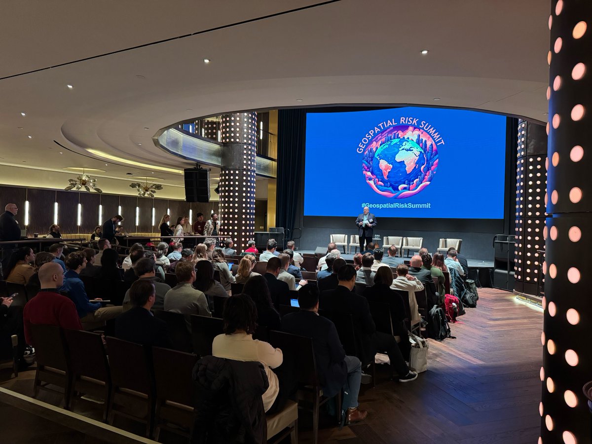
At #GeospatialRiskSummit TGI’s <a href="/RachelOpitz/">Rachel Opitz</a> &amp; <a href="/mcolegeo/">Marge Cole</a> were excited to be part of talks on how #geospatial shapes #riskmanagement across industries. This perfectly aligns with #TGI 's work on #foodsecurity &amp; #sustainability via the #GIFS challenge.  👉 tinyurl.com/2mz9ynkf
Cesium (@cesiumjs) 's Twitter Profile Photo

Submit your presentation proposal for #CesiumDevCon! - Advancing 3D geospatial - Infrastructure & AECO - Aerospace, national security, & critical infrastructure - Gaming and simulation - Climate and sustainability - Openness Submissions due February 21: hubs.li/Q034pxM30

Submit your presentation proposal for #CesiumDevCon!
- Advancing 3D geospatial
- Infrastructure &amp; AECO
- Aerospace, national security, &amp; critical infrastructure
- Gaming and simulation
- Climate and sustainability
- Openness

Submissions due February 21: hubs.li/Q034pxM30
TaylorGeospatial (@taylorgeostl) 's Twitter Profile Photo

We’re all set for second #TGI #GIFS Workshop today! Excited to have #JoeCornelius, CEO, Gates AG One, delivering introductory remarks! His leadership in advancing #aginnovations for #foodsecurity is key to shaping future of #globalfoodsecurity. 👉 tinyurl.com/yzvt9jnp

We’re all set for second #TGI #GIFS Workshop today! Excited to have #JoeCornelius, CEO, Gates AG One, delivering  introductory remarks! His leadership in advancing #aginnovations for #foodsecurity is key to shaping future of #globalfoodsecurity. 👉 tinyurl.com/yzvt9jnp
TaylorGeospatial (@taylorgeostl) 's Twitter Profile Photo

Big thanks to Phil Cooper Amazon Web Services for kicking off #TGI #GeoAIWorkingGroup on Feb 6. Great presentations from: Sacha Lepretre of #LuxCarta on #3Dmapping with #AI Jesse Kallman of #Danti on multi-model AI for #disasterresponse Excited about upcoming #GeoAI meetings on Mar 6 & Apr 3.
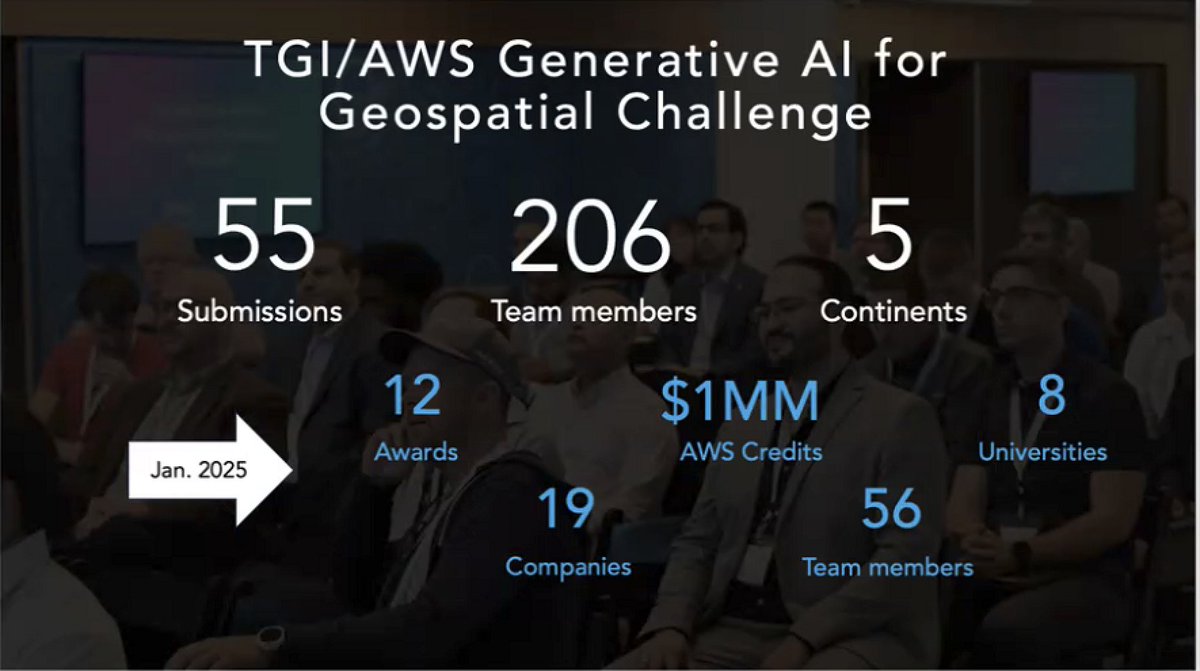
Big thanks to Phil Cooper <a href="/AWS/">Amazon Web Services</a> for kicking off #TGI #GeoAIWorkingGroup on Feb 6. Great presentations from:
Sacha Lepretre of #LuxCarta on #3Dmapping with #AI
Jesse Kallman of #Danti on multi-model AI for #disasterresponse
Excited about upcoming #GeoAI meetings on Mar 6 &amp; Apr 3.
ESA Earth Observation (@esa_eo) 's Twitter Profile Photo

😬Almost 40% of glaciers in Central Europe were lost between 2000 and 2023. A new study, using data from various satellite🛰️observations -including ESA's CryoSat mission mission- reveals alarming insights about the declining rate of glaciers. Read the full study🔗

😬Almost 40% of glaciers in Central Europe were lost between 2000 and 2023.

A new study, using data from various satellite🛰️observations -including <a href="/esa_cryosat/">ESA's CryoSat mission</a> mission- reveals alarming insights about the declining rate of glaciers.

Read the full study🔗
NASAEarthdata (@nasaearthdata) 's Twitter Profile Photo

ICYMI: The second NASA ICESat-2 data training webinar, "Laser Altimetry Applications for a Changing World: Working with ICESat-2 Land and Vegetation Height Data" is available for viewing online. Watch it here: go.nasa.gov/3QmR3k7 @NASA_Ice #NASA #EarthData