John Hickey (@onwithjohnwx) 's Twitter Profile
John Hickey

@onwithjohnwx

Weather Consulting company owned by Meteorologist John Hickey. John is a proud LSC (now @NVU_Lyndon) grad ('10). John and his wife reside in Northeast PA.

ID: 223468435

linkhttps://linkin.bio/onwithjohnweatherconsulting calendar_today06-12-2010 13:41:11

40,40K Tweet

6,6K Followers

2,2K Following

John Hickey (@onwithjohnwx) 's Twitter Profile Photo

With some clearing being noted, low level lapse rates are steepening. Scattered storms are likely this afternoon with isolated storms producing severe criteria wind damage. Here's the latest statement from NWS Binghamton about the severe weather risk.
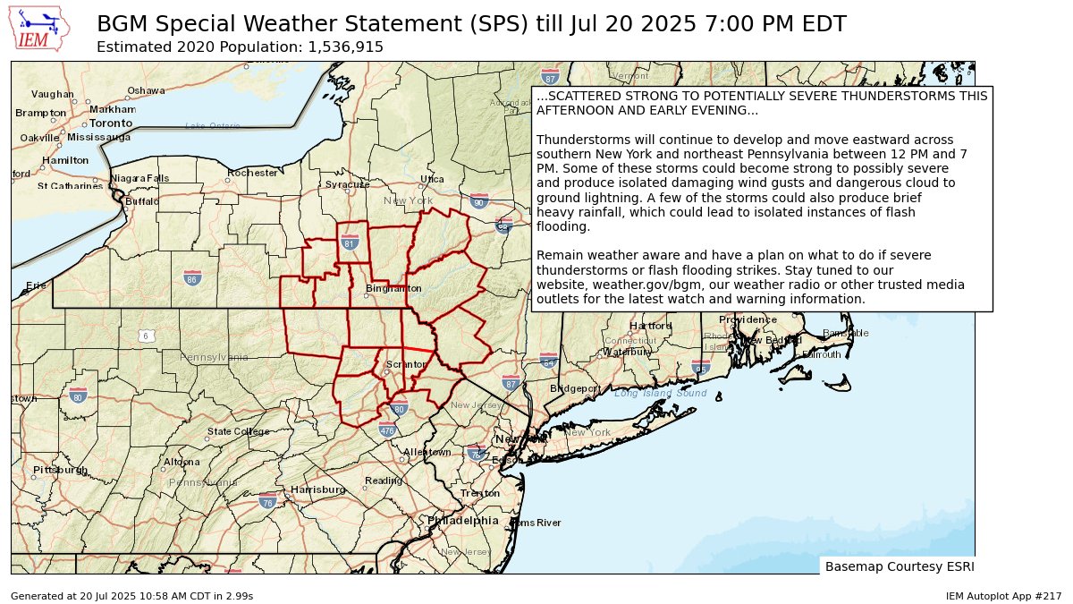
With some clearing being noted, low level lapse rates are steepening.  Scattered storms are likely this afternoon with isolated storms producing severe criteria wind damage.  Here's the latest statement from <a href="/NWSBinghamton/">NWS Binghamton</a> about the severe weather risk.
John Hickey (@onwithjohnwx) 's Twitter Profile Photo

Good Monday morning ☕️ - comfortable air and cooler temps setting up for a couple of days. Canadian high pressure system settling in. Tonight will be the coolest. ~50 valleys with 40s in the mountains. Lopez... 40-42 degrees 🥶. Dry weather next 3 days.

Good Monday morning ☕️ - comfortable air and cooler temps setting up for a couple of days.  Canadian high pressure system settling in.  Tonight will be the coolest.  ~50 valleys with 40s in the mountains.  Lopez... 40-42 degrees 🥶.  Dry weather next 3 days.
John Hickey (@onwithjohnwx) 's Twitter Profile Photo

Good Tuesday morning ☕️ - cool start with temps in the 50s (valleys) 40s (mountains). As of 5AM, down to 49 in Lopez. Other communities in the Northern Tier are colder than the "ice box". Lots of sun w/ crisp air today. Turning warmer and more humid Wednesday & Thursday.

Good Tuesday morning ☕️ - cool start with temps in the 50s (valleys) 40s (mountains).  As of 5AM, down to 49 in Lopez.  Other communities in the Northern Tier are colder than the "ice box".  Lots of sun w/ crisp air today.  Turning warmer and more humid Wednesday &amp; Thursday.
John Hickey (@onwithjohnwx) 's Twitter Profile Photo

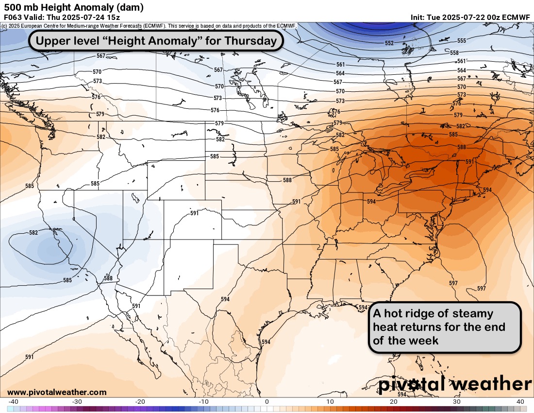
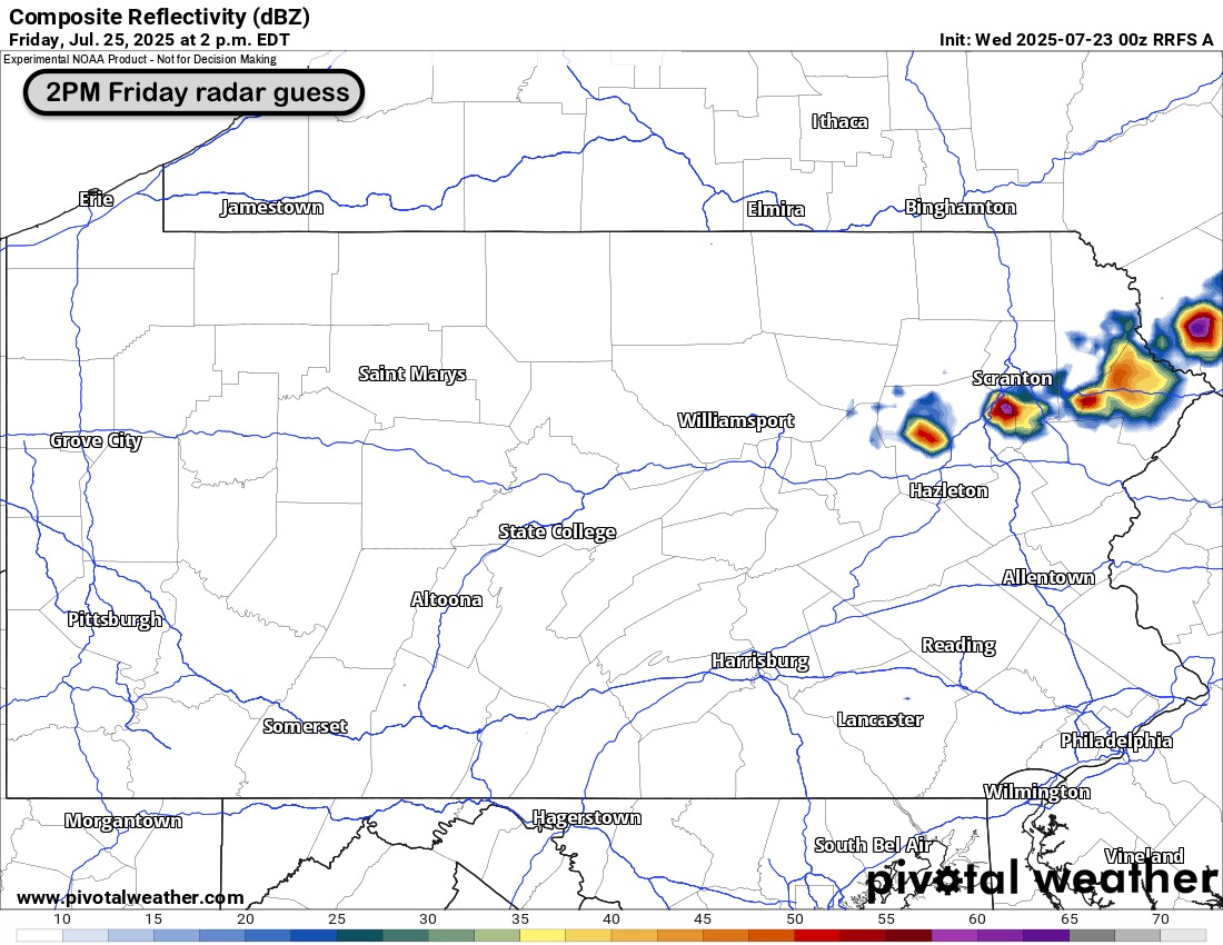
Happy 🐪 day ☕️ - warm sunshine today with slightly higher humidity. Steam heat returns Thursday. ~90 but feeling hotter with tropical humidity. Hot, humid Friday with scattered storms likely. Isolated severe storms possible. Rough timing 11AM - 5PM. Front timing TBD.

Happy 🐪 day ☕️ - warm sunshine today with slightly higher humidity.  Steam heat returns Thursday.  ~90 but feeling hotter with tropical humidity.  Hot, humid Friday with scattered storms likely.  Isolated severe storms possible.  Rough timing 11AM - 5PM.  Front timing TBD.
John Hickey (@onwithjohnwx) 's Twitter Profile Photo

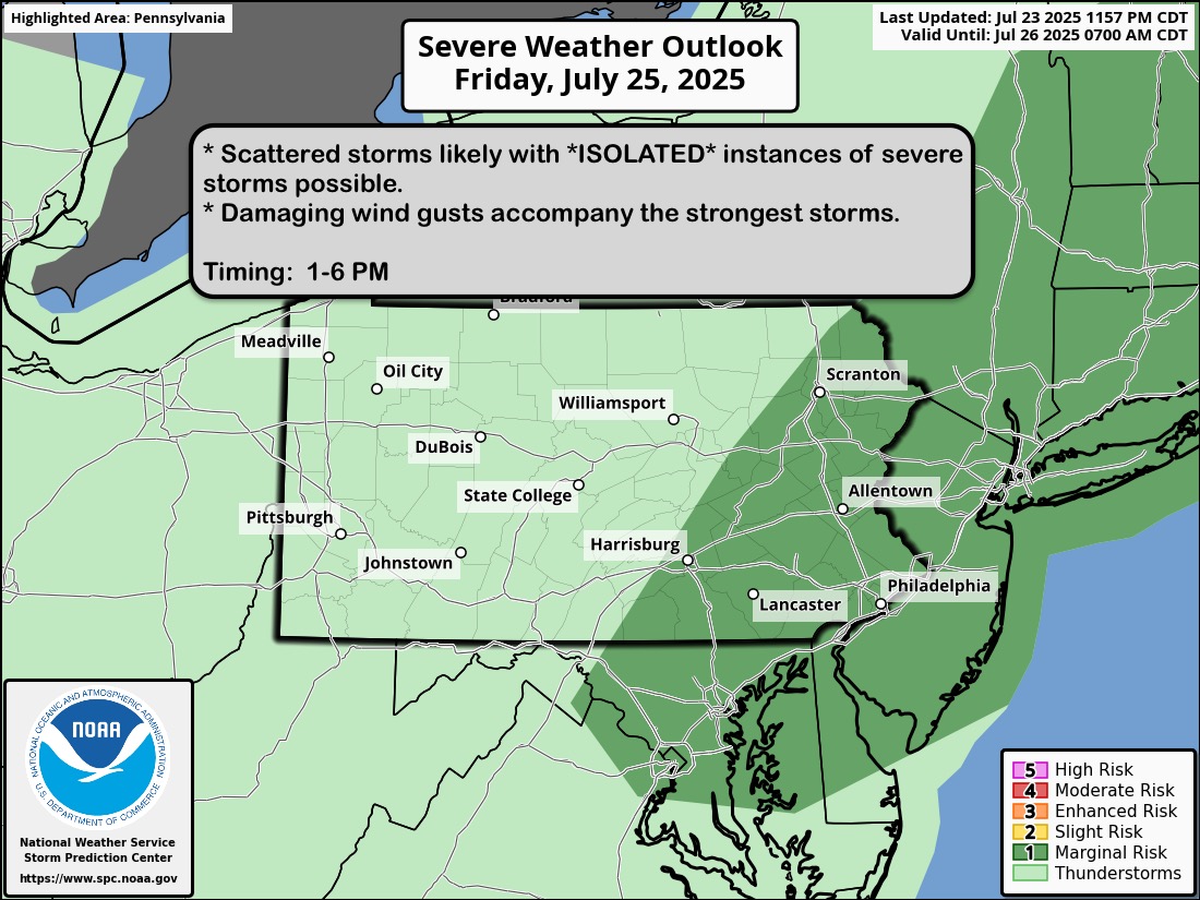
Good Thursday morning ☕️ - swamp A$$ weather returns with highs near 90 and high humidity this afternoon. This continues thru the weekend. Friday storms (~1-6PM) come with a low end risk to turn severe; coverage of storms will be numerous. Garden variety storms Saturday afternoon

Good Thursday morning ☕️ - swamp A$$ weather returns with highs near 90 and high humidity this afternoon. This continues thru the weekend. Friday storms (~1-6PM) come with a low end risk to turn severe; coverage of storms will be numerous. Garden variety storms Saturday afternoon
John Hickey (@onwithjohnwx) 's Twitter Profile Photo

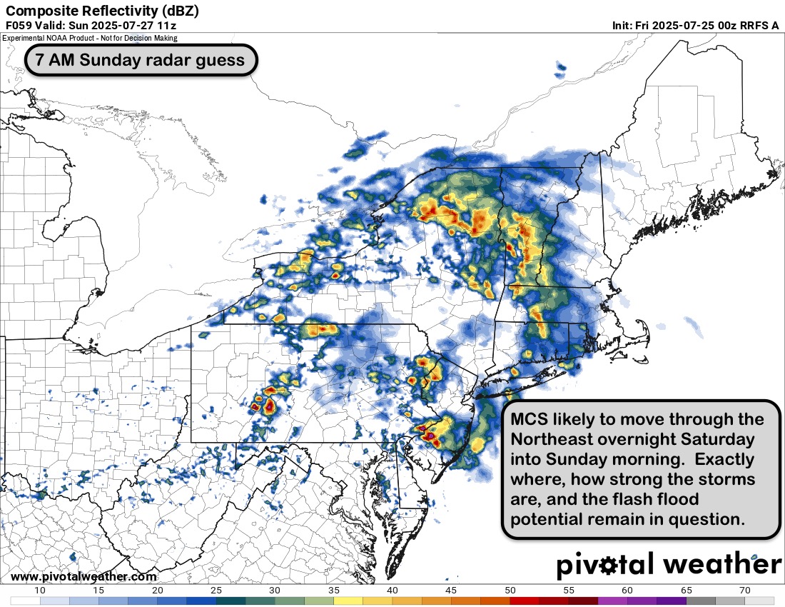
TGIF ☕️ - it's a steam bath out there this morning! Cold front brings scattered storms; isolated severe storm with damaging winds possible ~1-6 PM. Less humid on Saturday before tropical surge Saturday night into Sunday morning. MCS storms possible Sat night into Sun AM.

TGIF ☕️ - it's a steam bath out there this morning!  Cold front brings scattered storms; isolated severe storm with damaging winds possible ~1-6 PM.  Less humid on Saturday before tropical surge Saturday night into Sunday morning.  MCS storms possible Sat night into Sun AM.
John Hickey (@onwithjohnwx) 's Twitter Profile Photo

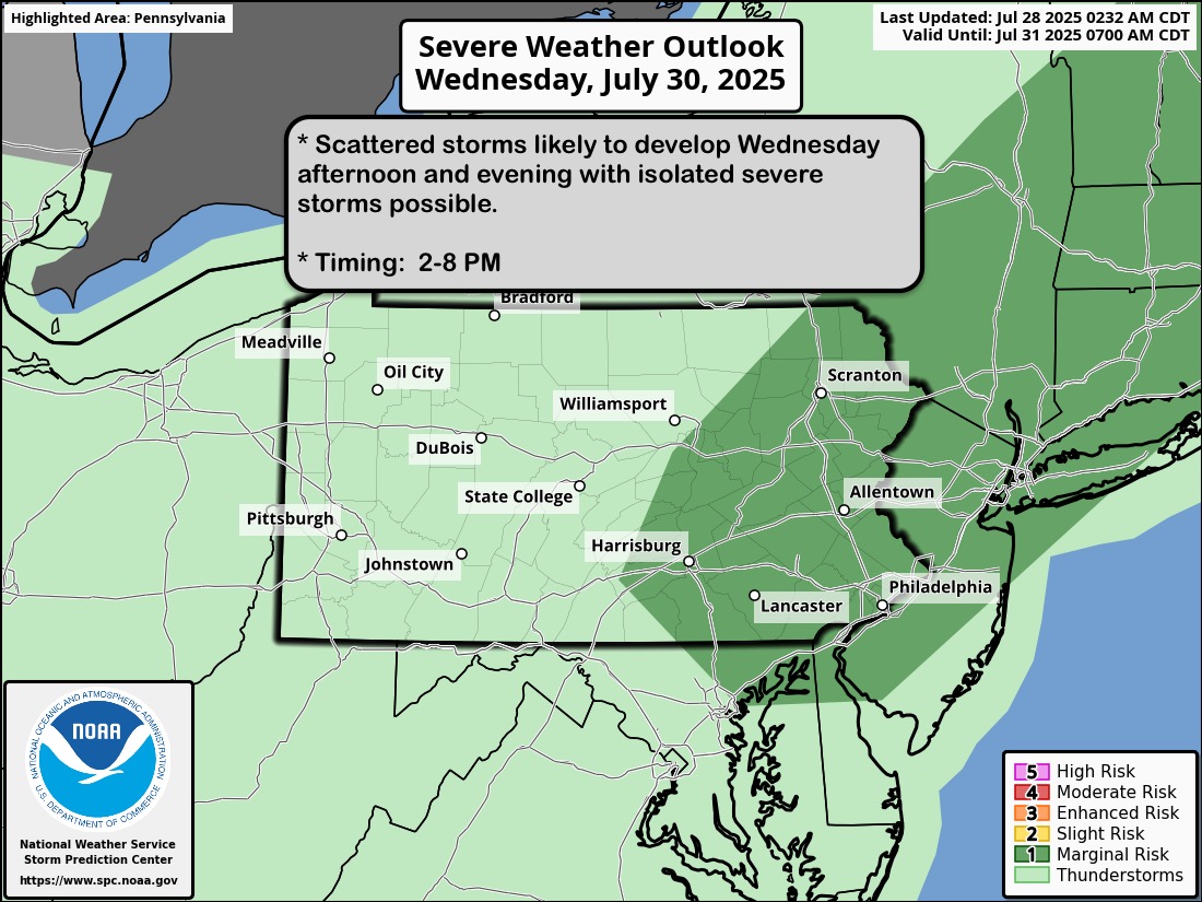
Good Monday morning ☕️ - HOT start to the week with highs near 90 today. Low 90s on Tuesday with "feels like" temperatures 95-100. Still ~90 Wednesday with scattered thunderstorms likely 2-8PM. Isolated severe storm risk for Northeast PA. Will monitor.

Good Monday morning ☕️ - HOT start to the week with highs near 90 today.  Low 90s on Tuesday with "feels like" temperatures 95-100.  Still ~90 Wednesday with scattered thunderstorms likely 2-8PM.  Isolated severe storm risk for Northeast PA.  Will monitor.
John Hickey (@onwithjohnwx) 's Twitter Profile Photo

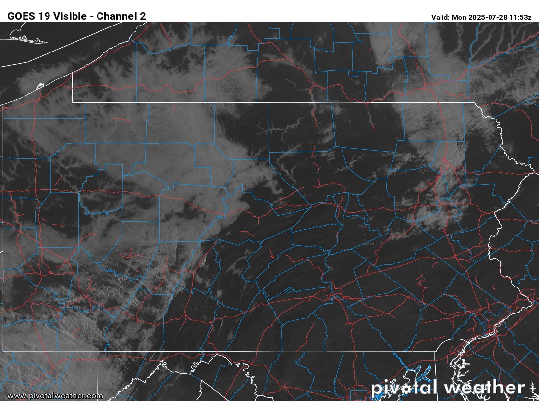
There’s a lot of sun for PARTS of Northeast PA this morning. We’ll all get into it later this morning. Just a little cloudy spell for a couple hours.

There’s a lot of sun for PARTS of Northeast PA this morning.  We’ll all get into it later this morning.  Just a little cloudy spell for a couple hours.
John Hickey (@onwithjohnwx) 's Twitter Profile Photo

I’m really looking forward to not feeling like this after Every. Single. Run. 🏃 Walking thoughts video with an announcement 📢 coming soon.

John Hickey (@onwithjohnwx) 's Twitter Profile Photo

Good Tuesday morning ☕️ - HOT & HUMID today. "Feels like" temps ~100. The same goes for Wednesday. Cold front brings sct'd storms, isolated severe 3-8PM Wednesday. Numerous rounds of downpours on Thursday. Heaviest in the Poconos where there's a higher risk for flash flooding

Good Tuesday morning ☕️ - HOT &amp; HUMID today.  "Feels like" temps ~100.  The same goes for Wednesday. Cold front brings sct'd storms, isolated severe 3-8PM Wednesday.  Numerous rounds of downpours on Thursday.  Heaviest in the Poconos where there's a higher risk for flash flooding
John Hickey (@onwithjohnwx) 's Twitter Profile Photo

That’s ElkMountainPA in the distance as viewed from Greenfield Township. Hot, humid days like this have me day dreaming about big snow storms and powder days on the slopes ⛷️

That’s <a href="/ElkMountainSki/">ElkMountainPA</a> in the distance as viewed from Greenfield Township.  Hot, humid days like this have me day dreaming about big snow storms and powder days on the slopes ⛷️