Rob Marty (@robamarty) 's Twitter Profile
Rob Marty

@robamarty

Data Scientist @ World Bank

ID: 614822321

linkhttps://ramarty.github.io calendar_today22-06-2012 03:55:19

188 Tweet

301 Followers

366 Following

Sveta Milusheva (@smilusheva3) 's Twitter Profile Photo

Transport research in Econ is still largely focused on upper and upper-middle income countries. We need to continue investing in research that will inform what policies can work in low income settings through programs like ieConnect

Alice Duhaut (@alice_duh) 's Twitter Profile Photo

Join us tomorrow to learn more about geo spatial data for monitoring and evaluation and impact evaluation! I will be delighted to present research done under the ieConnect program @ Dime WB, with Rob Marty

Arianna Legovini (@alegovini) 's Twitter Profile Photo

Curfews restrict freedom of movement & are at best controversial. In Kenya, we looked at whether they helped road safety. They didn't. Curfews reduced crashes during restricted hours but equally increased accidents before the curfew as drivers rushed home. documents1.worldbank.org/curated/en/099…

Soren Iverson (@soren_iverson) 's Twitter Profile Photo

Whatever copywriter at Apple came up with Nico finding and BATHING an entire family of raccoons is far more unhinged than I could ever dream of being

Whatever copywriter at Apple came up with Nico finding and BATHING an entire family of raccoons is far more unhinged than I could ever dream of being
David Evans (@daveevansphd) 's Twitter Profile Photo

Curfews in Nairobi during COVID-19 led "to large reductions in crashes during the curfew hours when cars are off the road, but...reductions can be fully offset by an increase in crashes...when people rush to get home before the curfew starts." documents1.worldbank.org/curated/en/099…

Curfews in Nairobi during COVID-19 led "to large reductions in crashes during the curfew hours when cars are off the road, but...reductions can be fully offset by an increase in crashes...when people rush to get home before the curfew starts." documents1.worldbank.org/curated/en/099…
Yohan (@yohaniddawela) 's Twitter Profile Photo

Night time satellite data is one of the most promising proxies for economic growth. • How does it work? • How accurate is it? • What are its issues? Having worked on this extensively during my PhD and after, here’s everything you need to know:

Yohan (@yohaniddawela) 's Twitter Profile Photo

Soon we won't be able to use nightlights as a proxy for economic growth. Why? It's due to limitations of its spectral bands. Here's the breakdown in simple terms:

Soon we won't be able to use nightlights as a proxy for economic growth.

Why?

It's due to limitations of its spectral bands.

Here's the breakdown in simple terms:
Yohan (@yohaniddawela) 's Twitter Profile Photo

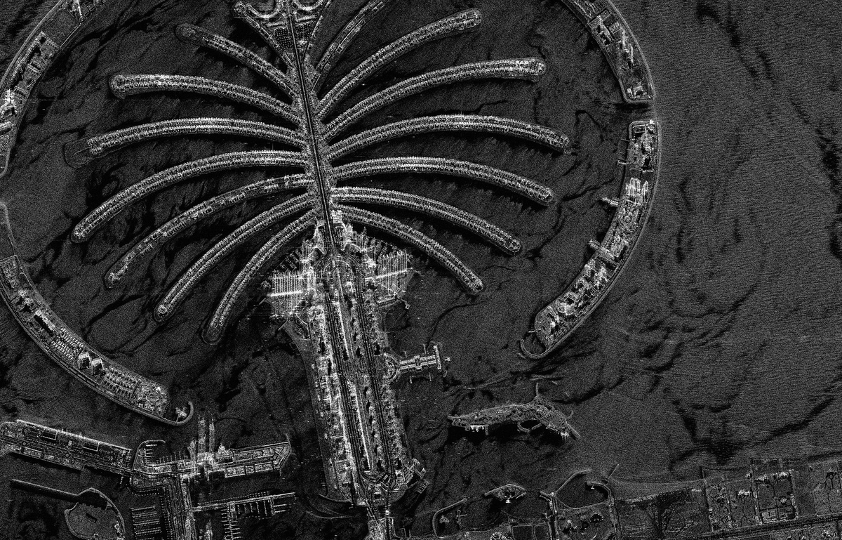
Economics is slow to adopt breakthroughs in earth observation. There’s super high-res satellite data that sees through clouds, works at night, and in any weather conditions. Here’s how SAR data will revolutionise spatial economics:

Economics is slow to adopt breakthroughs in earth observation.

There’s super high-res satellite data that sees through clouds, works at night, and in any weather conditions.

Here’s how SAR data will revolutionise spatial economics:
Yohan (@yohaniddawela) 's Twitter Profile Photo

NASA's Black Marble is the most accurate source of nightlights data. However, it's difficult to use. Here are the exact steps you need to take to work with Black Marble data:

NASA's Black Marble is the most accurate source of nightlights data.

However, it's difficult to use.

Here are the exact steps you need to take to work with Black Marble data:
World Bank Data (@worldbankdata) 's Twitter Profile Photo

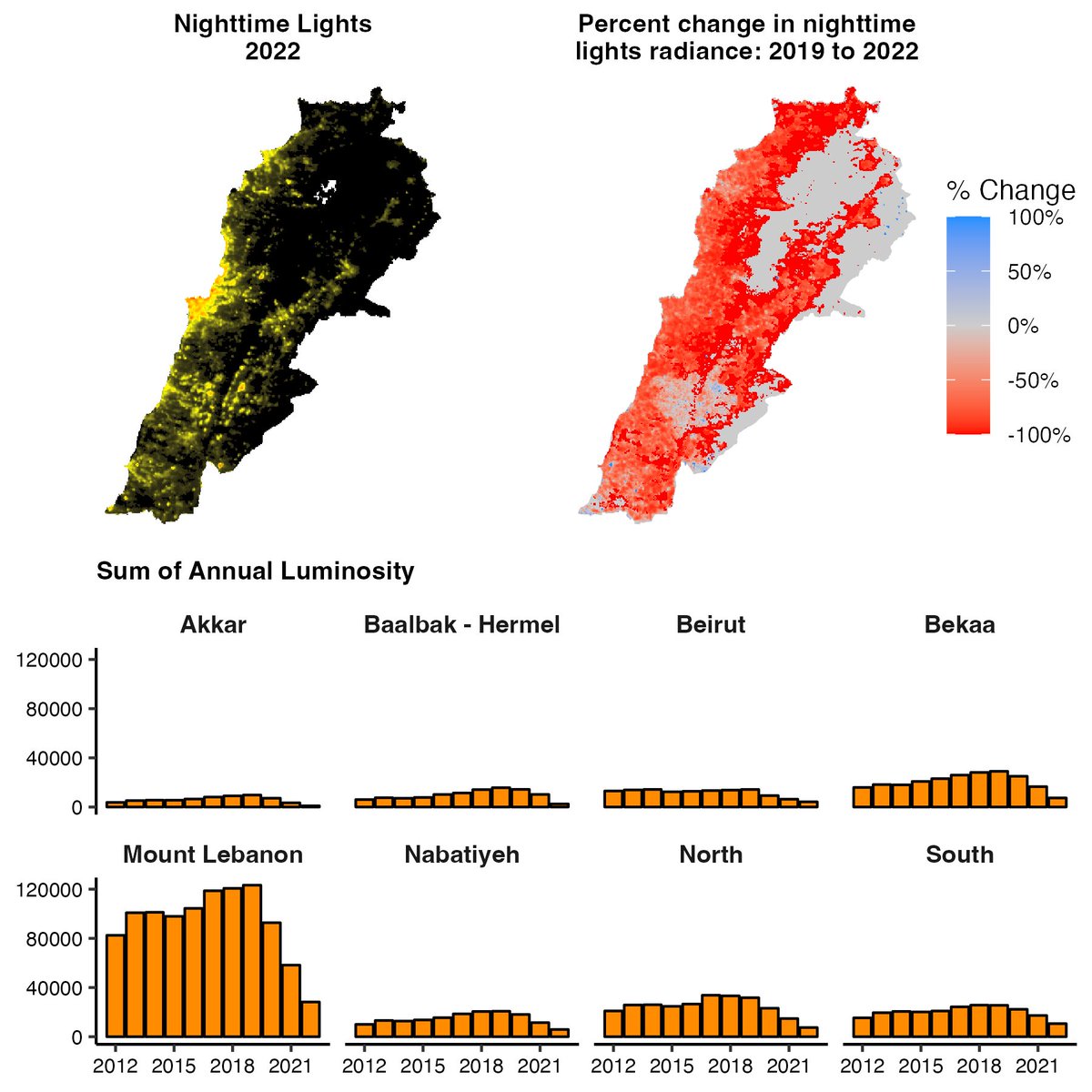
Harness the power of NASA's Black Marble data for groundbreaking analysis: From economic activity to disaster recovery, our research presents user-friendly #R & #Python packages to unlock nighttime lights data's potential. Learn more in our blog post: wrld.bg/sA1s50QAl6t

World Bank Data (@worldbankdata) 's Twitter Profile Photo

Interested in tracking urbanization trends, conflict areas or economic activity? Discover the potential of NASA's #BlackMarble #data with our latest blog post, and explore how #R and #Python packages simplify data access and analysis. 🛰️ wrld.bg/ysUG50QAlnq

Interested in tracking urbanization trends, conflict areas or economic activity? 

Discover the potential of <a href="/NASA/">NASA</a>'s #BlackMarble #data with our latest blog post, and explore how #R and #Python packages simplify data access and analysis.

🛰️ wrld.bg/ysUG50QAlnq
Arianna Legovini (@alegovini) 's Twitter Profile Photo

Our spring recruitment drive just went online! Join the fantastic DIME team. We put research and creativity to the service of people, prosperity and the planet. worldbank.org/en/research/di…

World Bank Data (@worldbankdata) 's Twitter Profile Photo

Interested in tracking urbanization trends, conflict areas or economic activity? Discover the potential of NASA's #BlackMarble #data with our latest blog post, and explore how #R and #Python packages simplify data access and analysis. 🛰️ wrld.bg/wzkN50R5VFP

Interested in tracking urbanization trends, conflict areas or economic activity? 

Discover the potential of <a href="/NASA/">NASA</a>'s #BlackMarble #data with our latest blog post, and explore how #R and #Python packages simplify data access and analysis.

🛰️ wrld.bg/wzkN50R5VFP
Estación R (@estacion_erre) 's Twitter Profile Photo

[PAQUETE 📦] - ¿Trabajas con info de tráfico? Con {googletraffic} vas poder armar data georreferenciada a partir de la información de tráfico de Google Maps en tiempo real. 🌐 dime-worldbank.github.io/googletraffic/ ✍🏼 Rob Marty World Bank #RStats #RStatsES #Rtips #DataScience

[PAQUETE 📦] - ¿Trabajas con info de tráfico? 

Con {googletraffic} vas poder armar data georreferenciada a partir de la información de tráfico de Google Maps en tiempo real. 
 
🌐 dime-worldbank.github.io/googletraffic/
✍🏼 <a href="/robamarty/">Rob Marty</a> <a href="/WorldBank/">World Bank</a> 
 
#RStats #RStatsES #Rtips #DataScience
Yohan (@yohaniddawela) 's Twitter Profile Photo

Facebook's marketing API is primarily used by advertisers. But did you know it can also be used to derive geospatial poverty estimates? A new paper from World Bank Data has developed the methodology. Here's the breakdown:

Facebook's marketing API is primarily used by advertisers.

But did you know it can also be used to derive geospatial poverty estimates?

A new paper from <a href="/worldbankdata/">World Bank Data</a> has developed the methodology.

Here's the breakdown:
Arianna Legovini (@alegovini) 's Twitter Profile Photo

Just released! A crowdsourced dataset that maps 30,000 road crashes in Nairobi. Download here microdata.worldbank.org/index.php/cata…. This is work with Sveta Milusheva Lupe Bedoya Rob Marty to prioritize road safety investments and save people's lives on the roads journals.plos.org/plosone/articl…


Just released! A crowdsourced dataset that maps 30,000 road crashes in Nairobi. Download here microdata.worldbank.org/index.php/cata…. This is work with <a href="/smilusheva3/">Sveta Milusheva</a> <a href="/lupe_bedoya/">Lupe Bedoya</a> <a href="/robamarty/">Rob Marty</a> to prioritize road safety investments and save people's lives on the roads journals.plos.org/plosone/articl…