Victoria Scholl (@scholl_victoria) 's Twitter Profile
Victoria Scholl

@scholl_victoria

Remote sensing specialist

ID: 821749229022564357

calendar_today18-01-2017 16:00:58

490 Tweet

599 Followers

949 Following

Fabian Schneider (@fabdanis) 's Twitter Profile Photo

Remote Sensing-Based Forest Modeling Reveals Positive Effects of Functional Diversity on Productivity at Local Spatial Scale With @mdplongo Victoria Scholl Bernhard W. Schmid Felix Morsdorf Ryan Pavlick Michael Schaepman EugΓ©nie Paul-Limoges, David Schimel and Paul Moorcroft

Mike Koontz, PhD πŸ¦” (@_mikoontz) 's Twitter Profile Photo

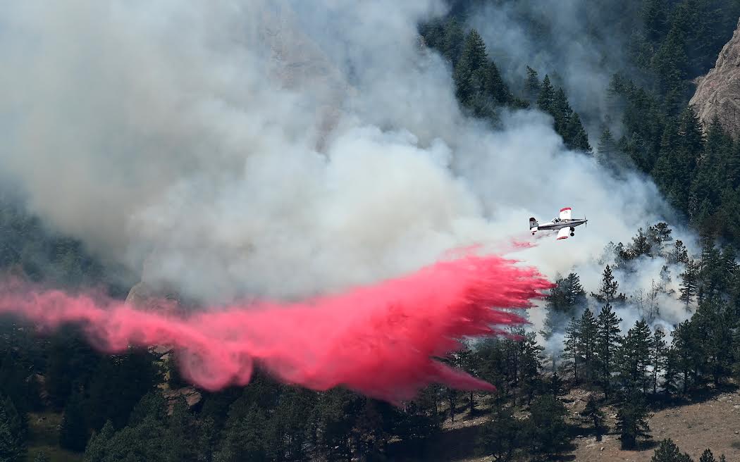
This is a set of fire/smoke/air quality monitoring resources put together by Earth Lab CU-Boulder and friends that is as relevant for the eastern US as it is for the west. Check the β€œair quality” section for some good web/mobile apps. Stay inside if you can! And wear a mask if you go out!
Martha Morrissey (@marth_hm) 's Twitter Profile Photo

Please join us in Boulder for SatCamp Sept 12-14! SatCamp is a new geospatial event that will allow for more meaningful conversations, connections, and collaboration outside instead of in a conference hall πŸŒ²πŸ”οΈβ˜€οΈ

Please join us in Boulder for SatCamp Sept 12-14! SatCamp is a new geospatial event that will allow for more meaningful conversations, connections, and collaboration outside instead of in a conference hall πŸŒ²πŸ”οΈβ˜€οΈ
USGS National Uncrewed Systems Office (NUSO) (@usgs_uas) 's Twitter Profile Photo

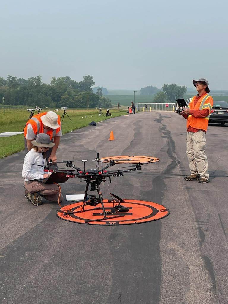
Last month, we coordinated with USGS Science in Utah, Bureau of Land Management Utah, and NEON to collect field, UAS, and airborne data in support of carbon sequestration research on public lands near Moab, Utah. 🏜️ Learn more: uas.usgs.gov/nupo/missions-…
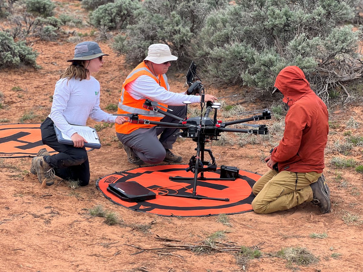

Last month, we coordinated with <a href="/USGS_UT/">USGS Science in Utah</a>, <a href="/BLMUtah/">Bureau of Land Management Utah</a>, and <a href="/NEON_sci/">NEON</a> to collect field, UAS, and airborne data in support of carbon sequestration research on public lands near Moab, Utah. 

🏜️ Learn more: uas.usgs.gov/nupo/missions-…
USGS EROS (@usgs_eros) 's Twitter Profile Photo

The USGS National Uncrewed Systems Office (NUSO) β€œdrone team” out of Denver recently flew their uncrewed aerial systems over EROS skies. Working with USGS EROS staff, the teams collected data to see if air-borne sensors on the drones could play a bigger role alongside satellites someday. πŸ”—usgs.gov/centers/eros/n…

The <a href="/USGS_UAS/">USGS National Uncrewed Systems Office (NUSO)</a> β€œdrone team” out of Denver recently flew their uncrewed aerial systems over EROS skies. Working with <a href="/USGS_EROS/">USGS EROS</a> staff, the teams collected data to see if air-borne sensors on the drones could play a bigger role alongside satellites someday. πŸ”—usgs.gov/centers/eros/n…
SeanGorman (@seangorman) 's Twitter Profile Photo

Excited to announce that satcamp.xyz is live and tickets are on sale! A huge thanks to all the volunteers and developmentseed's leadership and backing. Hope to see you all in Boulder for deep dives and adventures.

USGS EROS (@usgs_eros) 's Twitter Profile Photo

.Careers at Interior job alert! USGS EROS is hiring a Fire Science Physical Scientist. πŸ”₯ πŸ“… Closing date: August 9, 2023 πŸ”— usajobs.gov/job/739574500

.<a href="/DOICareers/">Careers at Interior</a> job alert! USGS EROS is hiring a Fire Science Physical Scientist. πŸ”₯

πŸ“… Closing date: August 9, 2023
πŸ”— usajobs.gov/job/739574500
USGS National Uncrewed Systems Office (NUSO) (@usgs_uas) 's Twitter Profile Photo

🌲 New B-Roll video! Footage from flying #drones over a wetland in Alaska to collect and compare methane measurements as permafrost thaws (2023). Watch the full video here: usgs.gov/media/videos/u…

Sasha Reed (@ecology_awesome) 's Twitter Profile Photo

Oh, soil ❀️❀️❀️. We have our homes on you and get our food from you. You mitigate climate change and support biodiversity and are vast and deep. Plus you are straight up gorgeous. Too often we treat you like dirt. Soil science and management make me extra happy on #WorldSoilDay

USGS National Uncrewed Systems Office (NUSO) (@usgs_uas) 's Twitter Profile Photo

#UAS lidar data captures detailed information about topography, vegetation, and habitat structure. By collecting repeat scans as restoration activities proceed and vegetation regrowth occurs, researchers will compare pre- and post- restoration conditions at Ackerson Meadow.

#UAS lidar data captures detailed information about topography, vegetation, and habitat structure. By collecting repeat scans as restoration activities proceed and vegetation regrowth occurs, researchers will compare pre- and post- restoration conditions at Ackerson Meadow.
Sasha Reed (@ecology_awesome) 's Twitter Profile Photo

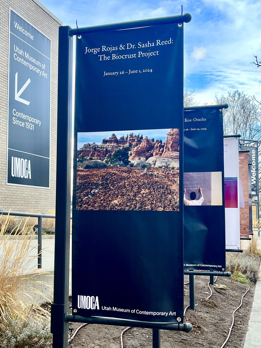
SO excited and nervous for tonight’s opening of The Biocrust Project exhibition at UMOCA! This art-science collaboration with the amazing artist Jorge Rojas and The Nature Conservancy has shifted my thinking in ways I wasn’t expecting. art+science=awesome utahmoca.org/exhibition/jor…

SO excited and nervous for tonight’s opening of The Biocrust Project exhibition at <a href="/utahmoca/">UMOCA</a>! This art-science collaboration with the amazing artist Jorge Rojas and <a href="/nature_org/">The Nature Conservancy</a> has shifted my thinking in ways I wasn’t expecting.

art+science=awesome 

utahmoca.org/exhibition/jor…
Victoria Scholl (@scholl_victoria) 's Twitter Profile Photo

This data release is finally published! It represents a team effort by a wonderful crew of USGS collaborators. We collected handheld spectrometer data and UAS imagery in support of mapping an invasive coastal reed plant.

This data release is finally published! It represents a team effort by a wonderful crew of USGS collaborators. We collected handheld spectrometer data and UAS imagery in support of mapping an invasive coastal reed plant.
USGS National Uncrewed Systems Office (NUSO) (@usgs_uas) 's Twitter Profile Photo

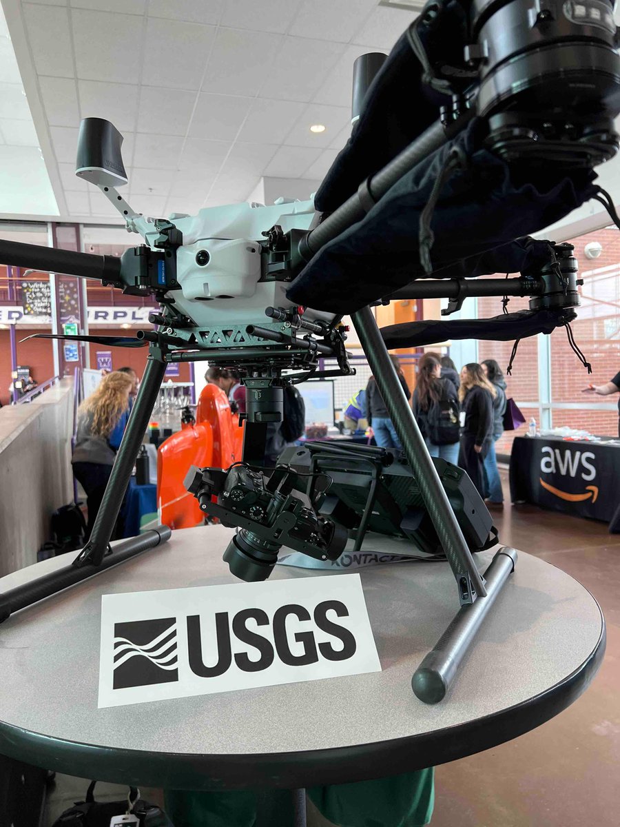
Today we’re participating in #Jeffcon2024, an interactive conference for Jefferson Country, Colorado high school students to explore career paths in the field of Information Technology! Jeffco IT #USGS #science #drones

Today we’re participating in #Jeffcon2024, an interactive conference for Jefferson Country, Colorado high school students to explore career paths in the field of Information Technology! <a href="/JeffcoIT/">Jeffco IT</a> #USGS #science #drones
ESIIL (@cu_esiil) 's Twitter Profile Photo

Apply by March 24th to join NASA and ESIIL this summer for HYR-SENSE. Visit our website to learn more and apply: esiil.org/hyr-sense

Apply by March 24th to join <a href="/NASA/">NASA</a> and ESIIL this summer for HYR-SENSE. Visit our website to learn more and apply: esiil.org/hyr-sense
Sasha Reed (@ecology_awesome) 's Twitter Profile Photo

This is one of my favorite collaborations and alongside it being about public lands and carbon (so much to β™₯️) it’s the chance to work with USGS National Uncrewed Systems Office (NUSO) that makes it so special (as well as @brookebosborne @R_C_OConnor @miggeograph WK Smith 🌎 Bureau of Land Management Utah NEON & others not on Twitter)
WK Smith 🌎 (@wkolby) 's Twitter Profile Photo

Happy to share a new review in #LandscapeEcology, "Applications of unoccupied aerial systems (UAS) in landscape ecology ...," expertly led by Miguel Villarreal and w/ an amazing team UArizona Ag, Life & Environmental Sciences UA School of Natural Resources and the Environment link.springer.com/article/10.100…
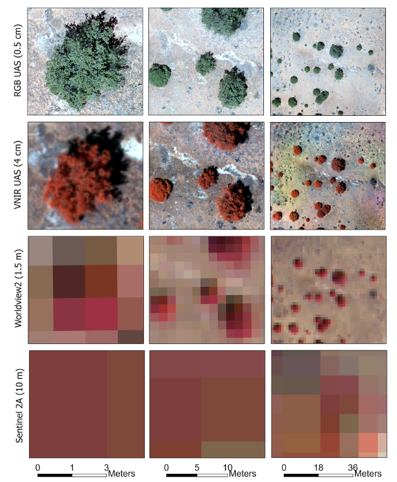
Happy to share a new review in #LandscapeEcology, "Applications of unoccupied aerial systems (UAS) in landscape ecology ...," expertly led by Miguel Villarreal and w/ an amazing team <a href="/UArizonaCALES/">UArizona Ag, Life & Environmental Sciences</a> <a href="/UASNRE/">UA School of Natural Resources and the Environment</a> link.springer.com/article/10.100…