Txomin Hermosilla (@txominhermos) 's Twitter Profile
Txomin Hermosilla

@txominhermos

Remote Sensing Research Scientist | Cartographer.
Canadian Forest Service @PFC_CFS, Natural Resources Canada @NRCan. Formerly @IRSS_UBC and @CGAT_UPV

ID: 1907867646

calendar_today26-09-2013 13:26:22

3,3K Tweet

1,1K Followers

1,1K Following

Lukas Winiwarter (@geogemgis) 's Twitter Profile Photo

Job opportunity! We, the Unit of Geometry and Surveying at @[email protected], are currently looking for a #postdoc to join our team investigating the use of #AI for #geodetic and #photogrammetric monitoring of #topographic changes in the #Alps.

Job opportunity! We, the Unit of Geometry and Surveying at <a href="/uniinnsbruck/">@uniinnsbruck@social.uibk.ac.at</a>, are currently looking for a #postdoc to join our team investigating the use of #AI for #geodetic and #photogrammetric monitoring of #topographic changes in the #Alps.
Dr. Joanne C. White (@joanne_c_white) 's Twitter Profile Photo

Climate sensitive growth and yield models in Canadian forestry: Challenges and opportunities pubs.cif-ifc.org/doi/10.5558/tf… #forest #growth #OpenAccess

USGS EROS (@usgs_eros) 's Twitter Profile Photo

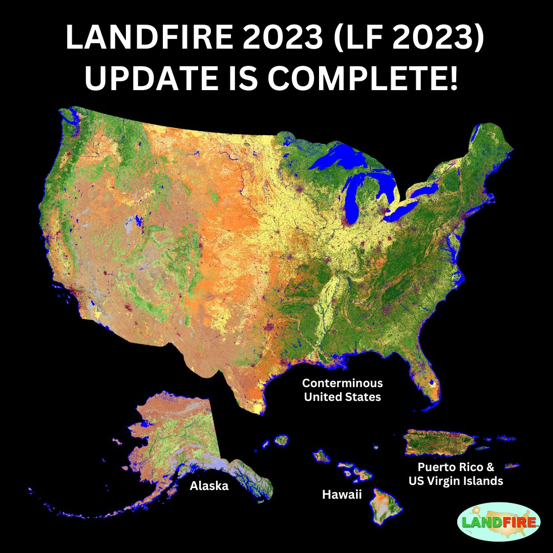
Exciting news for LANDFIRE data users! The LANDFIRE 2023 (LF 2023) Update is now complete. Get the latest data for Alaska, Hawaii, Puerto Rico, and the US Virgin Islands. Learn more here: ow.ly/tXYm50Ukiiz #FireScience #Landsat

Exciting news for <a href="/nature_LANDFIRE/">LANDFIRE</a> data users! The LANDFIRE 2023 (LF 2023) Update is now complete. Get the latest data for Alaska, Hawaii, Puerto Rico, and the US Virgin Islands. Learn more here: ow.ly/tXYm50Ukiiz
#FireScience #Landsat
Mike Wulder (@mikewulder) 's Twitter Profile Photo

We have developed a National Terrestrial Ecosystem Monitoring System (#NTEMS) for #Canada. ➡️Goal: science supported product development. #landcover #biomass #forestchange #forestrecovery #Landsat 🚨UPDATED 🚨 for background or your own literature review: researchgate.net/publication/35…

We have developed a National Terrestrial Ecosystem Monitoring System (#NTEMS) for #Canada.
➡️Goal: science supported product development.
#landcover #biomass #forestchange #forestrecovery #Landsat
🚨UPDATED 🚨 for background or your own literature review:
researchgate.net/publication/35…
Mike Wulder (@mikewulder) 's Twitter Profile Photo

Interesting and insightful overview of Earth Observation in 2024 and Outlook for 2025. "But, the truth is #Landsat is still the gold standard for satellite imaging, and together with Sentinel-1 and Sentinel-2, these missions represent the benchmark for EO data ..." #Sentinel2

Amy Wotherspoon, PhD (@dr_spoon) 's Twitter Profile Photo

Starting off the new year strong with a #Silva21 publication! Detection of disturbances using Harmonized #Landsat #Sentinel2 time series 🔗 doi.org/10.1016/j.ispr… (in @ISPRS) ✍️ @MadiSophiaBrown Coops (Integrated RS Studio) Mulverhill, Alexis Achim 🙏 NSERC / CRSNG @forestry.ubc.ca on Bluesky
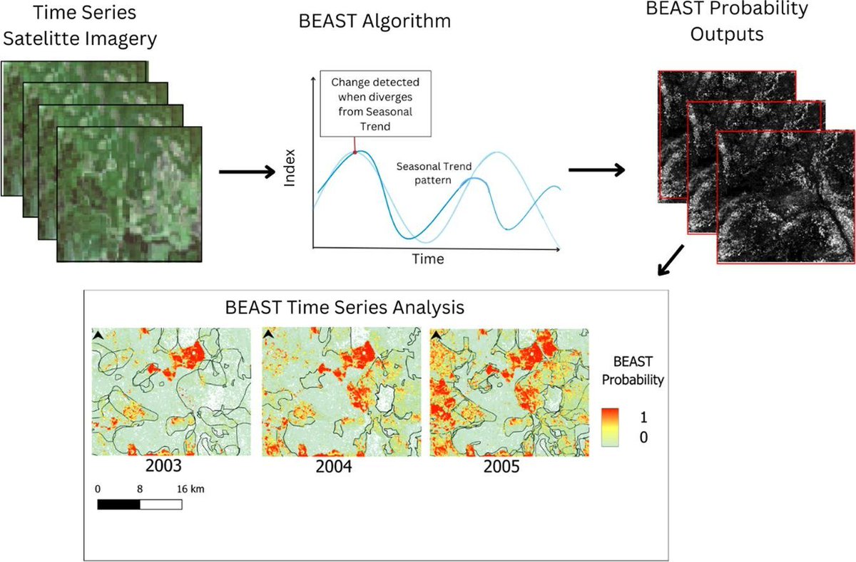
Starting off the new year strong with a #Silva21 publication! 

Detection of disturbances using Harmonized #Landsat #Sentinel2 time series

🔗 doi.org/10.1016/j.ispr… (in @ISPRS)
✍️ @MadiSophiaBrown Coops (<a href="/IRSS_UBC/">Integrated RS Studio</a>) Mulverhill, <a href="/AlexisAchim/">Alexis Achim</a> 
🙏 <a href="/NSERC_CRSNG/">NSERC / CRSNG</a> 

<a href="/UBCForestry/">@forestry.ubc.ca on Bluesky</a>
LeanderCampbell @bsky.social & @mas.to (@leandercampbell) 's Twitter Profile Photo

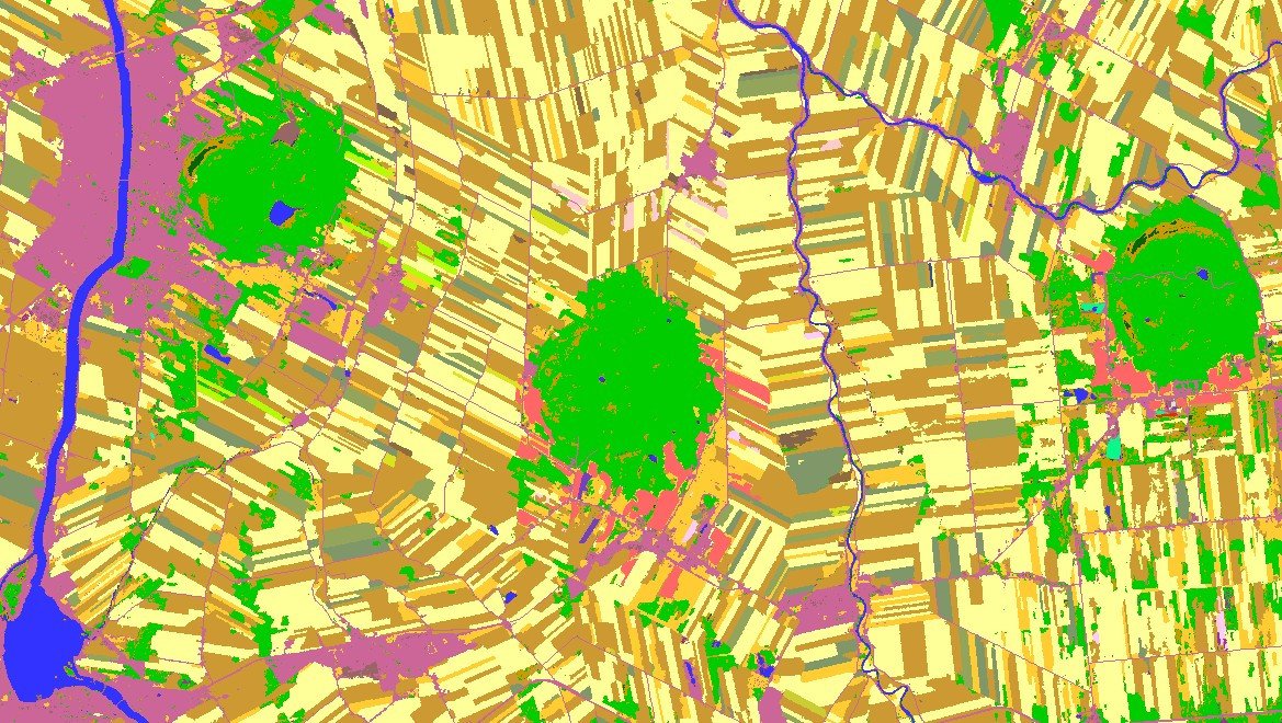
Our 2024 Annual Crop Inventory for the Ag extent of #Quebec has been released. open.canada.ca/data/en/datase… Attached is an overview of it & a look at 2 areas all with alt text descriptions. #CropMap24 #CdnAg #Landcover #Agriculture #Mapping #OpenData #EarthObservation #RemoteSensing

Our 2024 Annual Crop Inventory for the Ag extent of #Quebec has been released.
open.canada.ca/data/en/datase…

Attached is an overview of it &amp; a look at 2 areas all with alt text descriptions.

#CropMap24 #CdnAg #Landcover #Agriculture #Mapping #OpenData #EarthObservation #RemoteSensing
Mike Wulder (@mikewulder) 's Twitter Profile Photo

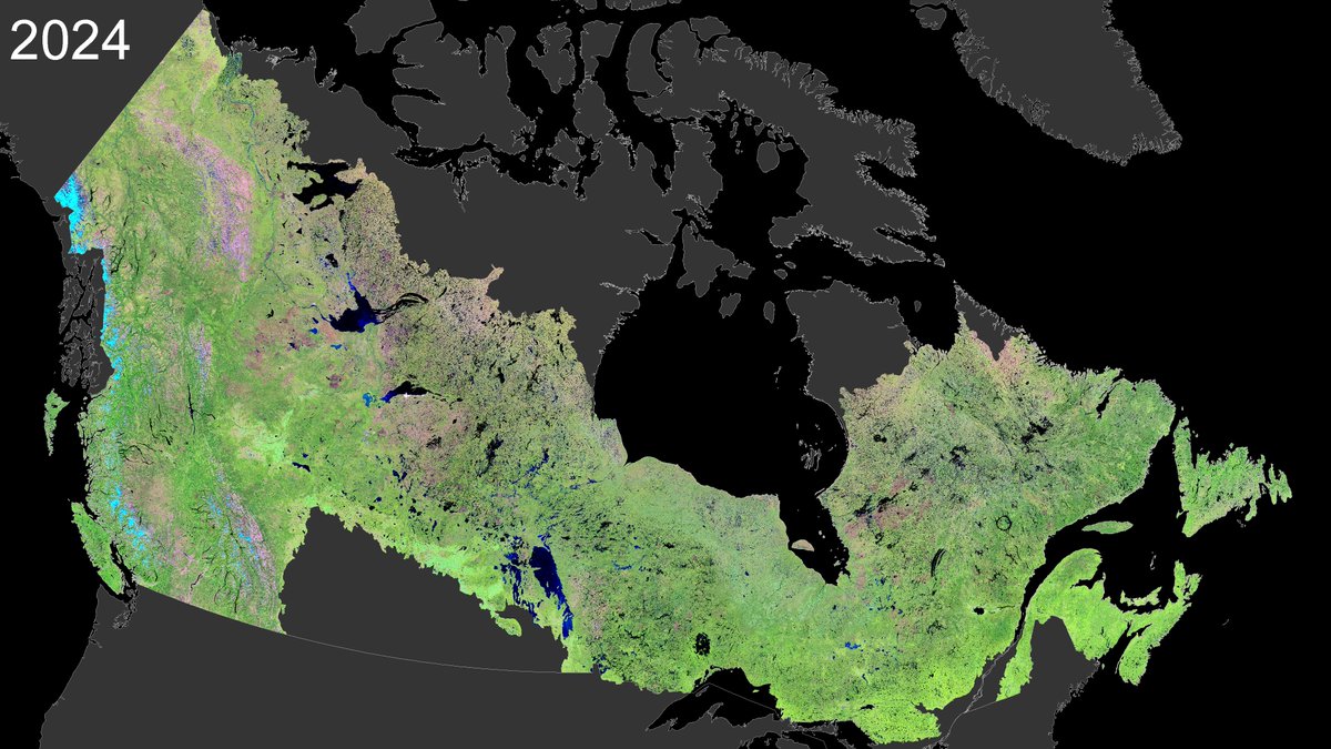
2024 mid-summer image composite of Canada's forests.🌲 Updating compositing methods and data sources. Now using 1000s of images per year of #opendata from Harmonized #Landsat #Sentinel2 (HLS). 30 m. Data is key input to National Terrestrial Ecosystem Monitoring System (#NTEMS).🇨🇦

2024 mid-summer image composite of Canada's forests.🌲
Updating compositing methods and data sources. Now using 1000s of images per year of #opendata from Harmonized #Landsat #Sentinel2 (HLS). 30 m.
Data is key input to National Terrestrial Ecosystem Monitoring System (#NTEMS).🇨🇦
Mike Wulder (@mikewulder) 's Twitter Profile Photo

Terrific news! Dr. Joanne C. White awarded for making a significant contribution to betterment of Canada with King Charles III Coronation Medal! 🎖️ Sustained & high impact achievements in #remotesensing, #lidar, satellite monitoring: science to actionable information. Yea Joanne! 👏
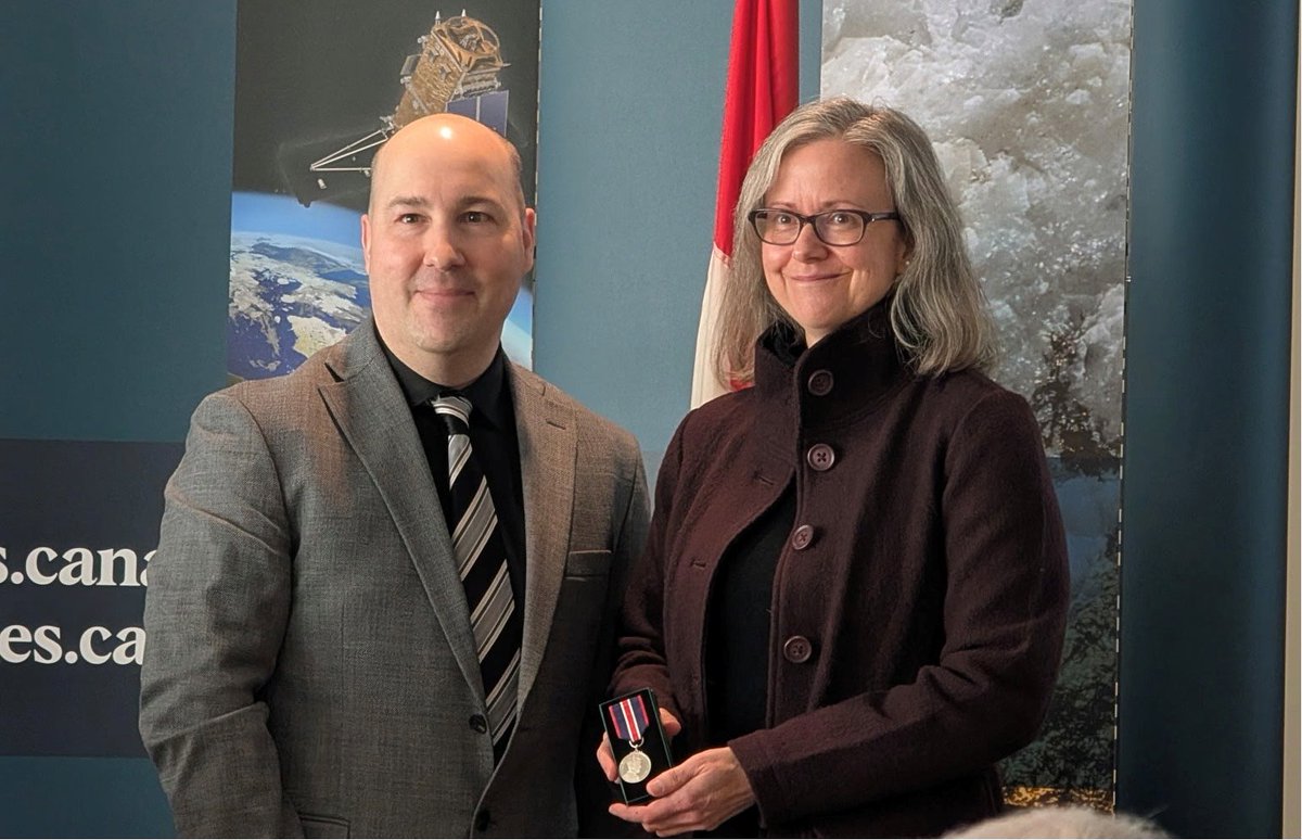
Terrific news!  <a href="/Joanne_C_White/">Dr. Joanne C. White</a> awarded for making a significant contribution to betterment of Canada with King Charles III Coronation Medal! 🎖️
Sustained &amp; high impact achievements in #remotesensing, #lidar, satellite monitoring: science to actionable information. Yea Joanne! 👏
Integrated RS Studio (@irss_ubc) 's Twitter Profile Photo

Amazing accomplishments for Dr. Joanne C. White, an extremely valued friend and collaborator of the IRSS! Congratulations!🎖️ Thank you for your ongoing contribution in the field of #RemoteSensing, as well as being an amazing example for #WomenInSTEM! 👏

Mike Wulder (@mikewulder) 's Twitter Profile Photo

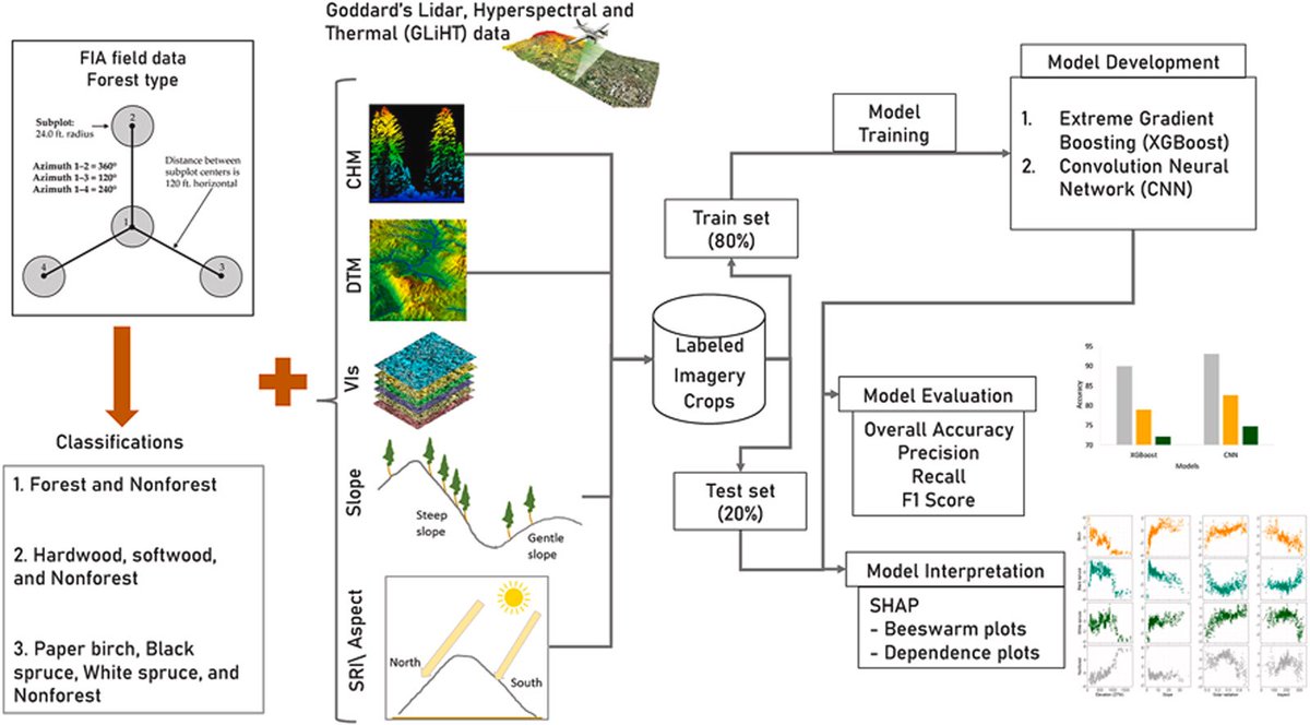
📢New: Khatri-Chhetri et al. Synthesizing field plot and airborne remote sensing data to enhance national forest inventory mapping in the boreal forest of Interior Alaska. -Fine grained 1m maps of forest type -CNN outperformed XGBoost #GLiHT #Lidar #NFI 🔗sciencedirect.com/science/articl…

📢New: Khatri-Chhetri et al. Synthesizing field plot and airborne remote sensing data to enhance national forest inventory mapping in the boreal forest of Interior Alaska.
-Fine grained 1m maps of forest type
-CNN outperformed XGBoost
#GLiHT #Lidar #NFI 
🔗sciencedirect.com/science/articl…
USGS Landsat (@usgslandsat) 's Twitter Profile Photo

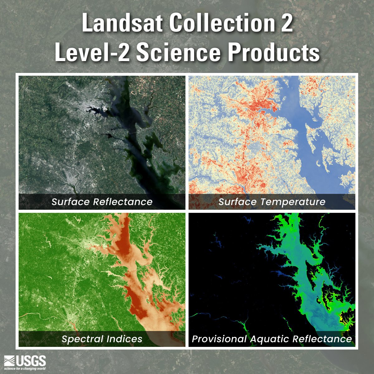
Did you know that the USGS provides research-quality, applications-ready #Landsat science products? Level-2 scene-based science products include #SurfaceReflectance, #SurfaceTemperature, #SpectralIndices, and Provisional #AquaticReflectance. More here: ow.ly/TQo450UOPIg

Did you know that the USGS provides research-quality, applications-ready #Landsat science products? Level-2 scene-based science products include #SurfaceReflectance, #SurfaceTemperature, #SpectralIndices, and Provisional #AquaticReflectance. More here: ow.ly/TQo450UOPIg
Di Yang 杨荻 (@yangdi1031) 's Twitter Profile Photo

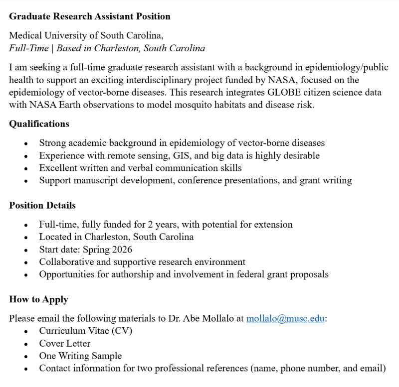
Now Hiring: Graduate Research Assistant Join the team at the Medical University of South Carolina for a fully funded, full-time position starting Spring 2026! #citizenscience #gis #NASAScience

Now Hiring: Graduate Research Assistant
Join the team at the Medical University of South Carolina for a fully funded, full-time position starting Spring 2026! #citizenscience #gis #NASAScience
SkogRover (@skogrover) 's Twitter Profile Photo

Big thanks to our invited speakers—research scientist Joanne White and senior scientist Lauri Korhonen—for their excellent presentations today at our seminar on forest inventory and monitoring. Tomorrow, they will act as opponents at Jaime Candelas Bielza's doctoral defense.

Big thanks to our invited speakers—research scientist Joanne White and senior scientist Lauri Korhonen—for their excellent presentations today at our seminar on forest inventory and monitoring. Tomorrow, they will act as opponents at Jaime Candelas Bielza's doctoral defense.
Mike Wulder (@mikewulder) 's Twitter Profile Photo

Announcement: Remote Sensing of Environment, Special Issue: ➡️Development, Validation, and Application of Medium- and High-Resolution Satellite Products at Regional to Global Scales Builds on Radeloff et al. 2024 (113918) data products review in RSE. See: sciencedirect.com/special-issue/…

Announcement:  Remote Sensing of Environment, Special Issue:
➡️Development, Validation, and Application of Medium- and High-Resolution Satellite Products at Regional to Global Scales
Builds on Radeloff et al. 2024 (113918) data products review in RSE.
See: sciencedirect.com/special-issue/…
Mike Wulder (@mikewulder) 's Twitter Profile Photo

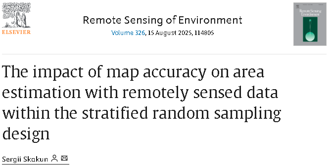
🛰️ Ever wonder how classification errors in remote sensing derived maps influence area estimates in stratified random sampling? 🤔 A new study explores the impact of map accuracy on area estimation and offers methods to mitigate biases. #landcover #landuse doi.org/10.1016/j.rse.…

🛰️ Ever wonder how classification errors in remote sensing derived maps influence area estimates in stratified random sampling? 🤔
A new study explores the impact of map accuracy on area estimation and offers methods to mitigate biases.
#landcover #landuse
doi.org/10.1016/j.rse.…