UC Water Institute (@ucanrwater) 's Twitter Profile
UC Water Institute

@ucanrwater

California Institute for Water Resources in the University of California, Agriculture & Natural Resources. Water research & extension. Posts not endorsements.

ID: 1354890464

linkhttp://ciwr.ucanr.edu/ calendar_today15-04-2013 17:30:32

23,23K Tweet

10,10K Followers

2,2K Following

California Department of Water Resources (@ca_dwr) 's Twitter Profile Photo

It’s been a dry January, so this is a good time to remind you of how we manage our #water during #flood season. Between October and April, DWR is required to operate certain reservoirs within the State Water Project for flood control under federal Water Control Manual Guidelines

It’s been a dry January, so this is a good time to remind you of how we manage our #water during #flood season.  Between October and April, DWR is required to operate certain reservoirs within the State Water Project for flood control under federal Water Control Manual Guidelines
UC Water Institute (@ucanrwater) 's Twitter Profile Photo

Have questions about the strong #AtmosphericRiver storms headed for Northern California? Ask our Daniel Swain at 1pm today via livestream

Jay Lund (@jaylund113) 's Twitter Profile Photo

In normal California units is about 16,000 acre-feet, enough to irrigate about 3,000 acres. Alas, this water would have been released to serve these same acres later, in the season when useful for the irrigation season. No relevance for fires. See: sjvwater.org/decision-to-du…

UC Water Institute (@ucanrwater) 's Twitter Profile Photo

Releases from the dams were “excess water that downstream districts are allowed to hold in reservoirs to hedge against dry years.” sjvwater.org/trumps-emergen…

Dr. Daniel Swain (@weather_west) 's Twitter Profile Photo

A major storm will arrive in California on Thursday, bringing a period of very heavy rain & risk of flooding esp. from SF Bay Area southward as well as strong gusty winds/isolated thunderstorms. Greatest concern, however, regards debris flow risk in SoCal wildfire zones. #CAwx

A major storm will arrive in California on Thursday, bringing a period of very heavy rain & risk of flooding esp. from SF Bay Area southward as well as strong gusty winds/isolated thunderstorms. Greatest concern, however, regards debris flow risk in SoCal wildfire zones. #CAwx
NWS Sacramento (@nwssacramento) 's Twitter Profile Photo

‼️ The Winter Storm Warning has been extended to portions of Shasta Co./Burney Basin between 500'-2000', including the city of Redding, from 10 pm tonight-10 am Thursday morning. Prepare for potential low elevation winter impacts across the northern Sacramento Valley! #CAwx

‼️ The Winter Storm Warning has been extended to portions of Shasta Co./Burney Basin between 500'-2000', including the city of Redding, from 10 pm tonight-10 am Thursday morning. Prepare for potential low elevation winter impacts across the northern Sacramento Valley!

#CAwx
UC Water Institute (@ucanrwater) 's Twitter Profile Photo

Join us for the next Ag&Natural Resources Water Webinar series on Feb. 24, '25 at 12PM, with Edith de Guzman and Greg Pierce on a timely topic: "Water supply and the Los Angeles fires: Emerging lessons and implications". Zoom links: tinyurl.com/anrwaterwebina… and at tinyurl.com/yuccgenm
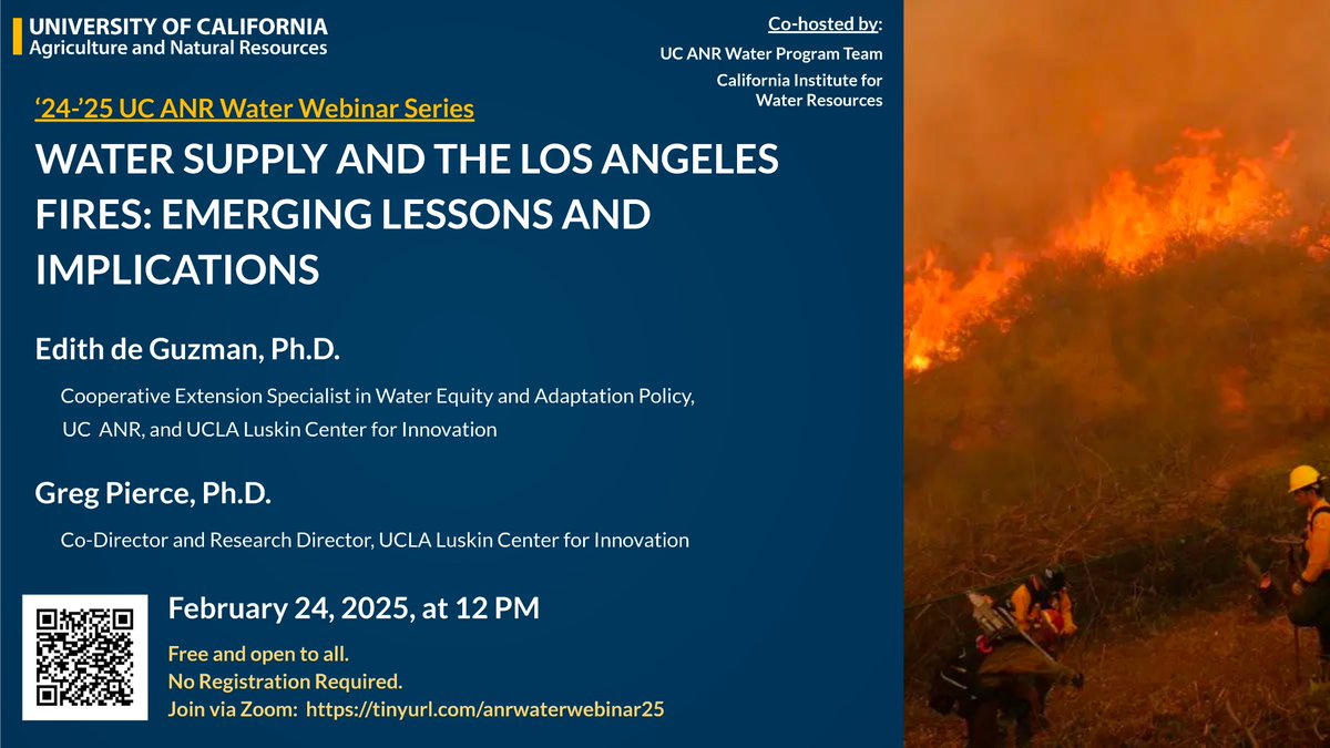
Join us for the next <a href="/ucanr/">Ag&Natural Resources</a> Water Webinar series on Feb. 24, '25 at 12PM, with <a href="/edithbdeguzman/">Edith de Guzman</a> and <a href="/gregspierce/">Greg Pierce</a> on a timely topic: "Water supply and the Los Angeles fires: Emerging lessons and implications". 

Zoom links: tinyurl.com/anrwaterwebina… and at tinyurl.com/yuccgenm
NWS Los Angeles (@nwslosangeles) 's Twitter Profile Photo

The main event of our current storm is on track for Thursday (Feb 13). Road flooding risk is high, stay off the roads is you can. #cawx #larain

The main event of our current storm is on track for Thursday (Feb 13).  Road flooding risk is high, stay off the roads is you can. #cawx #larain
NWS Sacramento (@nwssacramento) 's Twitter Profile Photo

As we move later into this evening, precipitation is expected to rapidly advance toward interior #NorCal, becoming more widespread overnight into Thursday. Here's a look at one model depiction of how that may evolve 👀 #CAwx

NWS Los Angeles (@nwslosangeles) 's Twitter Profile Photo

A band of heavy rain is moving through Ventura County, and will be moving into Los Angeles County in the next hour or two. Expect a rapid enhancement of rain with increased road flooding and risks of burn scar debris flows. #cawx #larain

Dr. Daniel Swain (@weather_west) 's Twitter Profile Photo

Over the next 3 hrs (~4-7pm PT), rainfall will (dramatically) intensify across Los Angeles County. Widespread heavy rain is likely, and localized torrential downpours & thunderstorms possible. Widespread street flooding likely,& high risk of wildfire burn area debris flows. #CAwx

Over the next 3 hrs (~4-7pm PT), rainfall will (dramatically) intensify across Los Angeles County. Widespread heavy rain is likely, and localized torrential downpours &amp; thunderstorms possible. Widespread street flooding likely,&amp; high risk of wildfire burn area debris flows. #CAwx
Colin McCarthy (@us_stormwatch) 's Twitter Profile Photo

BREAKING: Flash Flood Warning has been issued for the Palisades Fire burn scar, including Malibu and Pacific Palisades for the potential for deadly debris flows. Seek higher ground immediately if you encounter flood waters.

BREAKING: Flash Flood Warning has been issued for the Palisades Fire burn scar, including Malibu and Pacific Palisades for the potential for deadly debris flows. 

Seek higher ground immediately if you encounter flood waters.
NWS Storm Prediction Center (@nwsspc) 's Twitter Profile Photo

⚠️A significant severe weather outbreak is likely Fri/Sat (3-14 & 3-15)⚠️ A powerful storm system will support widespread damaging winds, strong tornadoes and large hail from Friday through Saturday night. See spc.noaa.gov and weather.gov for more info.

⚠️A significant severe weather outbreak is likely Fri/Sat (3-14 &amp; 3-15)⚠️

A powerful storm system will support widespread damaging winds, strong tornadoes and large hail from Friday through Saturday night. 

See spc.noaa.gov and weather.gov for more info.
Dr. Daniel Swain (@weather_west) 's Twitter Profile Photo

Line of convective precipitation, containing torrential downpours and locally damaging wind gusts over 60 mph, is currently moving though Bay Area. Unstable airmass associated w/this system will bring risk of burn area debris flows & isolated severe thunderstorms in SoCal. #CAwx

Line of convective precipitation, containing torrential downpours and locally damaging wind gusts over 60 mph, is currently moving though Bay Area. Unstable airmass associated w/this system will bring risk of burn area debris flows &amp; isolated severe thunderstorms in SoCal. #CAwx