Ken Graham (@wx4keg) 's Twitter Profile
Ken Graham

@wx4keg

National Weather Service

ID: 430307385

linkhttp://weather.gov calendar_today07-12-2011 00:48:24

1,1K Tweet

4,4K Followers

1,1K Following

Ken Graham (@wx4keg) 's Twitter Profile Photo

I led our National Weather Service daily operations call attended by DepSec of Commerce. Our agency is providing critical decision support for #Milton, a G4+ solar storm headed to Earth, 12 incident meteorologists deployed at wildfires, a Bering Sea Storm, and record heat. National Weather Service employees at work!

I led our <a href="/NWS/">National Weather Service</a> daily operations call attended by DepSec of Commerce.  Our agency is providing critical decision support for #Milton, a G4+ solar storm headed to Earth, 12 incident meteorologists deployed at wildfires, a Bering Sea Storm, and record heat. <a href="/NWS/">National Weather Service</a> employees at work!
Ken Graham (@wx4keg) 's Twitter Profile Photo

Called the heroes at NWS Tampa Bay and NWS Melbourne as they lower the shutters to ride out #Milton. They will be on duty along with our other National Weather Service offices to issue life-saving information on the front lines 24/7. To all National Weather Service employees, my heart felt thank you for your service.


Called the heroes at <a href="/NWSTampaBay/">NWS Tampa Bay</a> and <a href="/NWSMelbourne/">NWS Melbourne</a> as they lower the shutters to ride out #Milton. They will be on duty along with our other <a href="/NWS/">National Weather Service</a> offices to issue life-saving information on the front lines 24/7. To all <a href="/NWS/">National Weather Service</a> employees, my heart felt thank you for your service.
NWS Storm Prediction Center (@nwsspc) 's Twitter Profile Photo

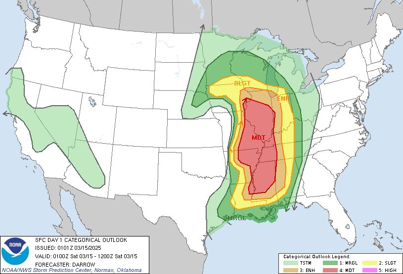
8:03pm CDT #SPC Day1 Outlook Moderate Risk: from the Mid-MISSISSIPPI Valley into the lower Mississippi Valley spc.noaa.gov/products/outlo…

8:03pm CDT #SPC Day1 Outlook Moderate Risk: from the Mid-MISSISSIPPI Valley into the lower Mississippi Valley spc.noaa.gov/products/outlo…
National Weather Service (@nws) 's Twitter Profile Photo

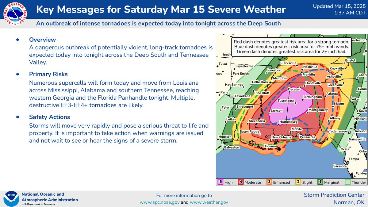
'Particularly Dangerous Situation' This wording is used in Tornado Watches for rare situations when long-lived and intense tornadoes are likely. Be prepared! Review your severe weather safety procedures. Know the safest place to seek refuge ahead of time. Consider canceling or

'Particularly Dangerous Situation'

This wording is used in Tornado Watches for rare situations when long-lived and intense tornadoes are likely.

Be prepared! Review your severe weather safety procedures. Know the safest place to seek refuge ahead of time. Consider canceling or
NWS Storm Prediction Center (@nwsspc) 's Twitter Profile Photo

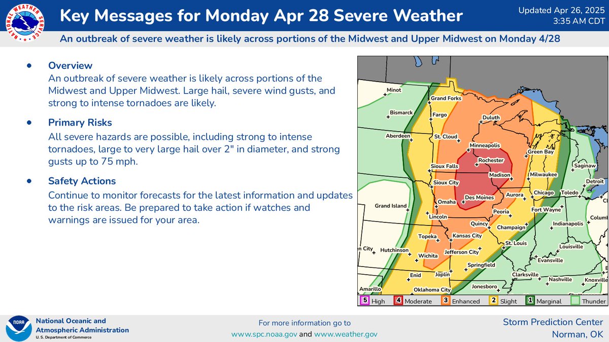
An outbreak of severe weather is likely across portions of the Midwest and Upper Midwest on Monday, April 28. Large hail, severe wind gusts, and strong to intense tornadoes are likely.

An outbreak of severe weather is likely across portions of the Midwest and Upper Midwest on Monday, April 28. Large hail, severe wind gusts, and strong to intense tornadoes are likely.
NWS Storm Prediction Center (@nwsspc) 's Twitter Profile Photo

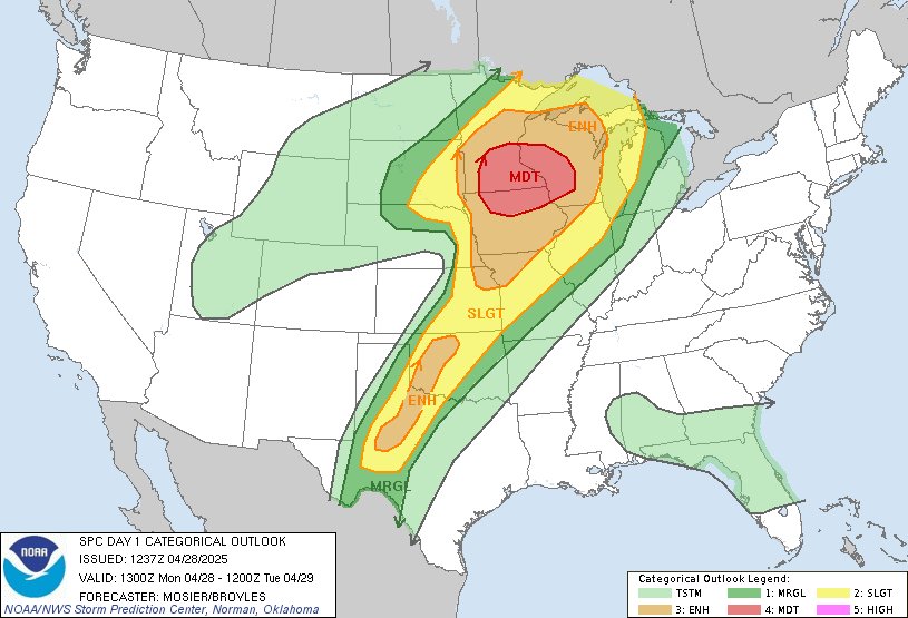
Multiple corridors of severe thunderstorms are expected across the Upper Midwest later today into tonight, with a regional severe weather outbreak possible. The most dangerous period is likely during the late afternoon and evening when strong tornado potential should be maximized

Multiple corridors of severe thunderstorms are expected across the Upper Midwest later today into tonight, with a regional severe weather outbreak possible. The most dangerous period is likely during the late afternoon and evening when strong tornado potential should be maximized
National Weather Service (@nws) 's Twitter Profile Photo

"Multiple corridors of severe thunderstorms are expected across the Upper Midwest later today into tonight (April 28), with a regional severe weather outbreak possible. The most dangerous period is likely during the late afternoon and evening when strong tornado potential should

"Multiple corridors of severe thunderstorms are expected across the Upper Midwest later today into tonight (April 28), with a regional severe weather outbreak possible. The most dangerous period is likely during the late afternoon and evening when strong tornado potential should
National Weather Service (@nws) 's Twitter Profile Photo

On severe weather days like today, hazardous weather often moves in very fast. It's important to plan ahead: ✅Have a way to get weather warnings ✅Move to a sturdy location as soon as you receive a warning

On severe weather days like today, hazardous weather often moves in very fast. It's important to plan ahead:
✅Have a way to get weather warnings
✅Move to a sturdy location as soon as you receive a warning
NWS Storm Prediction Center (@nwsspc) 's Twitter Profile Photo

A regional outbreak of severe thunderstorms is likely across parts of the middle Mississippi & Ohio Valleys Fri afternoon/Fri night. All hazards will be possible including tornadoes (some of which may be intense), damaging wind, and large hail. More info: spc.noaa.gov

A regional outbreak of severe thunderstorms is likely across parts of the middle Mississippi &amp; Ohio Valleys Fri afternoon/Fri night. All hazards will be possible including tornadoes (some of which may be intense), damaging wind, and large hail. More info: spc.noaa.gov